Field Applications
- Forestry
- Ubran
- Diverse Landcover
- Agriculture
- Marine / Riparian
- Atmosphere and Climate
- Defence and Security


eCognition® software is designed to improve, accelerate and automate the interpretation of images and geospatial data for environmental monitoring, resource development, infrastructure management and global security
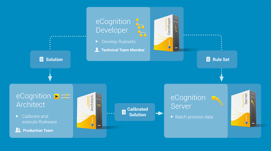
eCognition Developer is a powerful development environment for object-based image analysis. It is used in earth sciences to develop rule sets (or applications for eCognition Architect) for the automatic analysis of remote sensing data.
eCognition Architect enables non-technical professionals such as vegetation mapping experts, urban planners or foresters to leverage eCognition technology. Users can easily configure, calibrate and execute image analysis workflows created in eCognition Developer.
eCognition Server software provides a processing environment for batch execution of image analysis jobs.