Low Altitude Intelligent
Management and Analytics Platform Potential
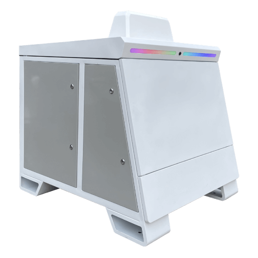
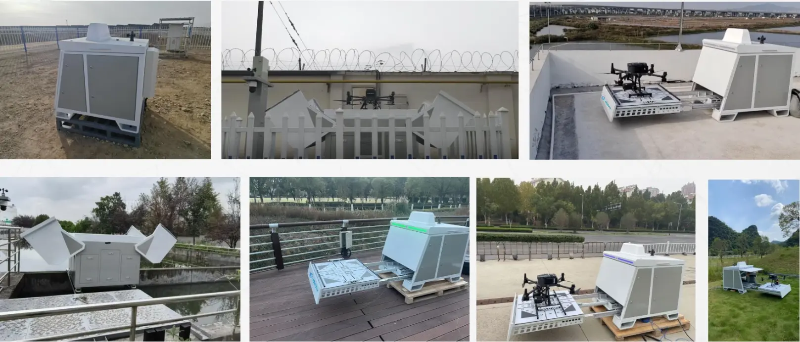
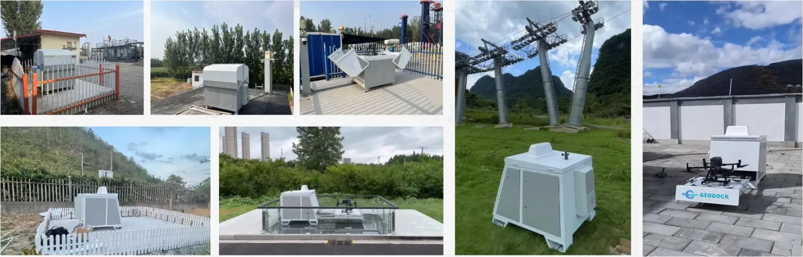
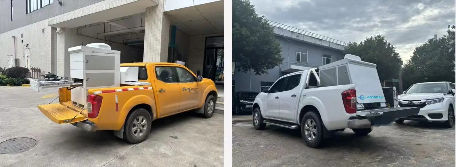
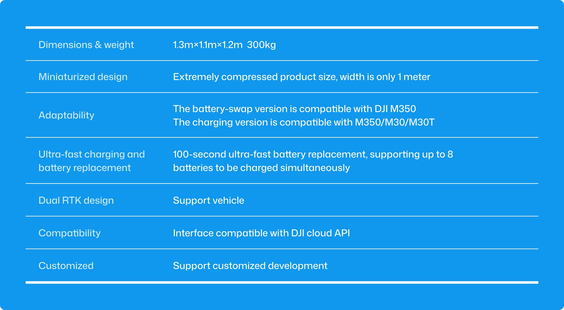
GeoDock
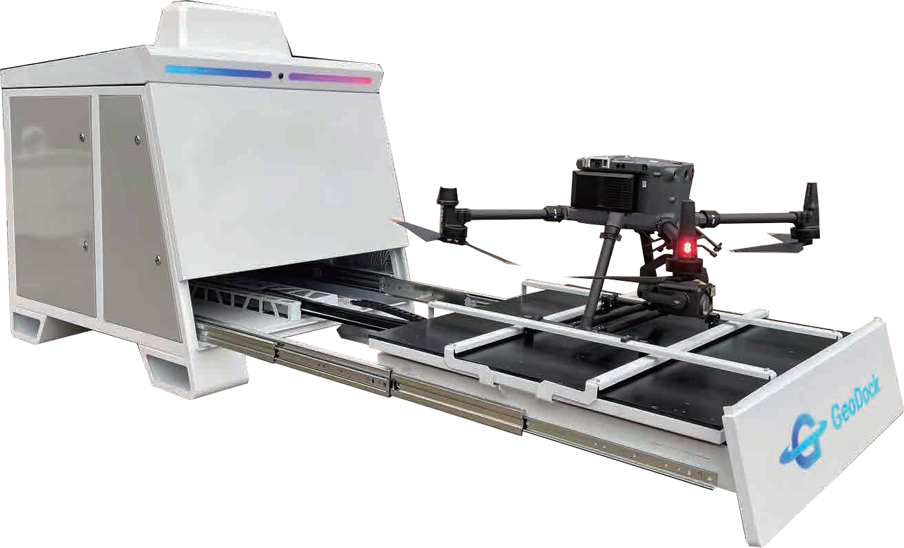
GeoDock Pro V4

About GeoFLY
A Low Altitude Intelligent
Management and Analytics Platform developed based on GeoTwin.
GeoFLY low-altitude application management and analysis platform adopts B/S architecture and fully open interfaces. It can be integrated with various types of platforms and supports private deployment.
The GeoFLY low-altitude application management and analysis platform adopts a B/S architecture with fully open interfaces. It can be docked and integrated with various types of platforms and supports private deployment.
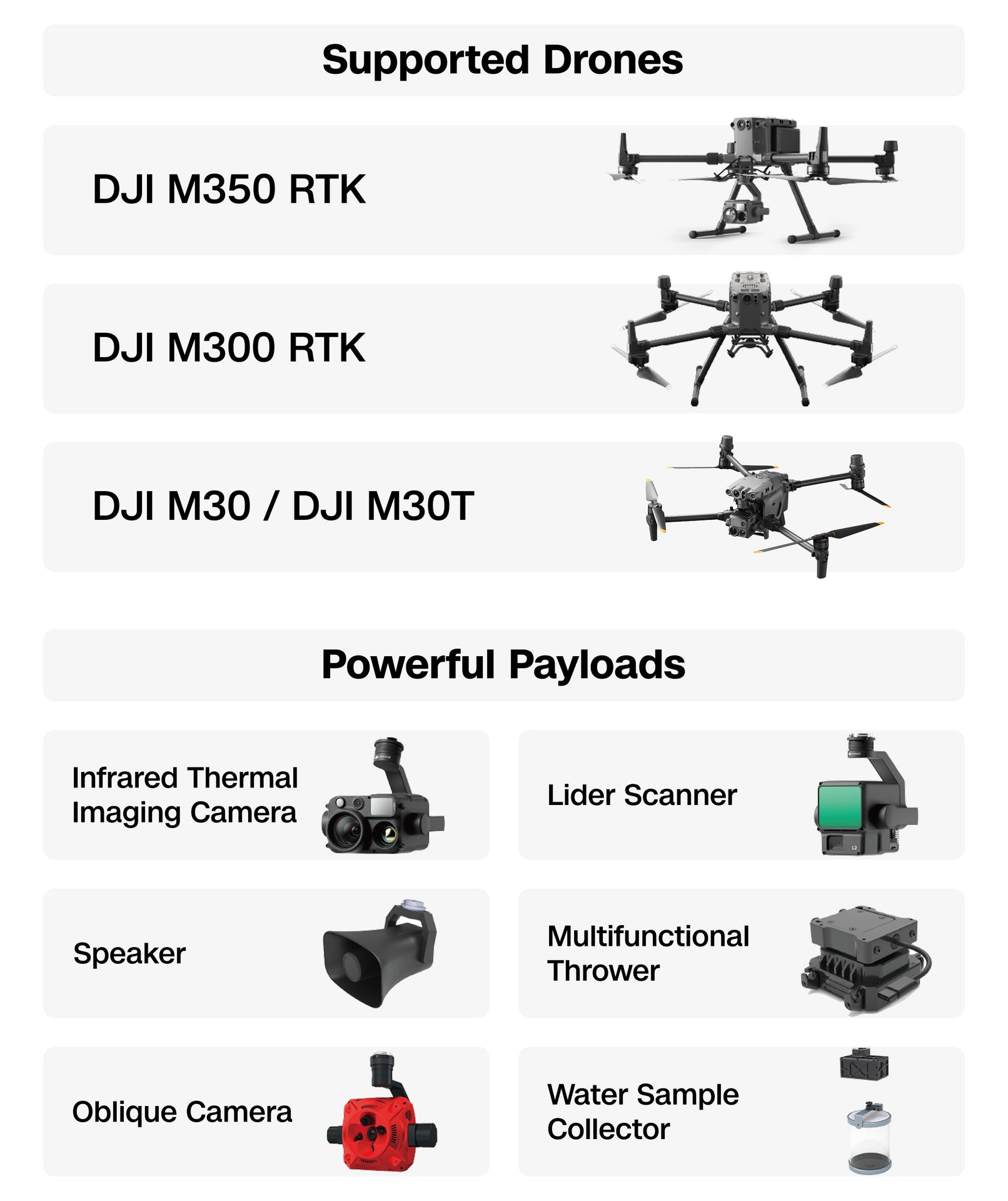
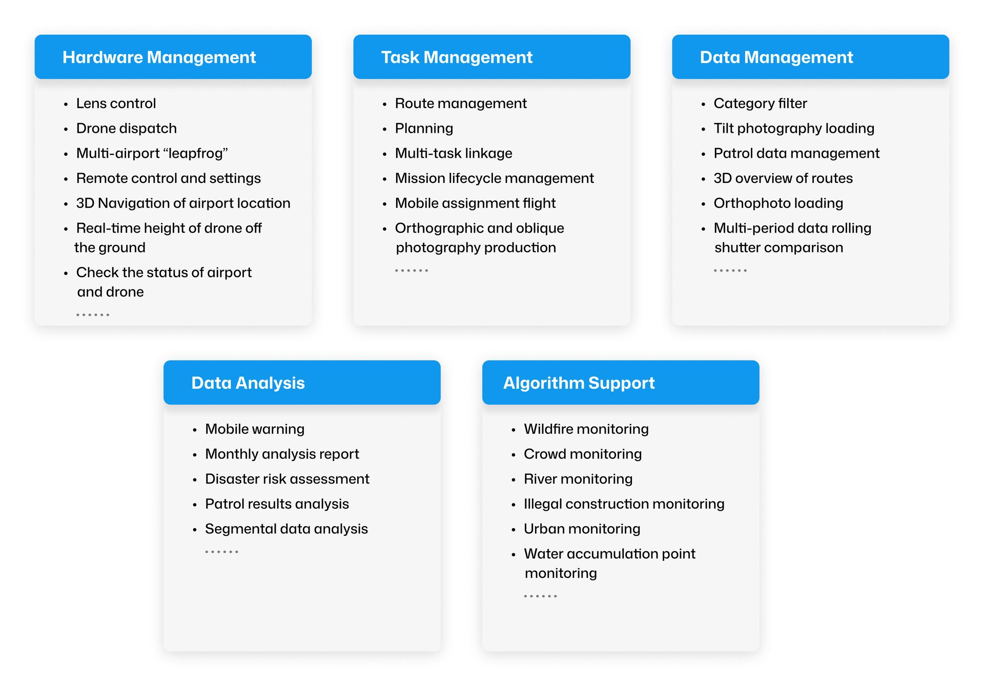
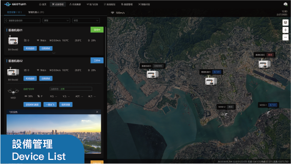
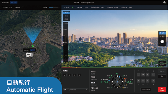
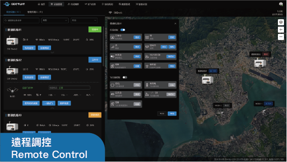
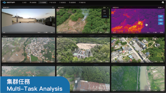
GeoFLY Platform Functions
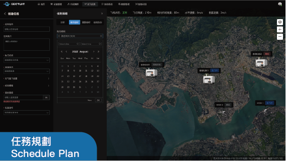
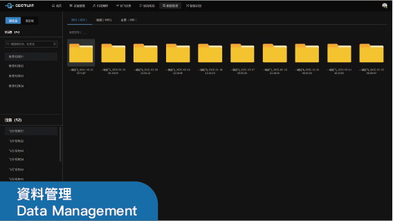
LAE Applications
Autonomous Scheduled Flight for Change Detection
Deploy an automated drone airport at the construction site and initiate a regular inspection mode. Periodically capture aerial photos to automatically generate 3D models, which allow for precise measurements and comparison with BIM real - models to monitor the project progress and quality. Automatically compare the changes in earthwork volume to accurately evaluate the project cost.
Moreover, it can periodically record videos. Through artificial intelligence, potential safety hazards and violations at the construction site can be detected in real - time. Relevant personnel will be automatically notified and alerted, and the handling progress will be tracked.
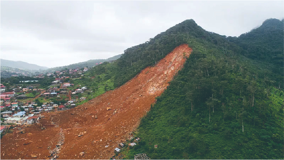
Emergency Flight Execution for Real-time Inspecticon
Deploy automated drone airports in a grid pattern. In case of extreme weather or after a disaster, the nearest airport can be activated. The mission can be remotely launched in an emergency, and the drone can quickly reach the scene within 15 minutes. It can immediately transmit high-definition images, comprehensively collect visible light and thermal sensing information, providing a reliable basis for emergency command. This enables rapid decision-making assistance at critical moments.
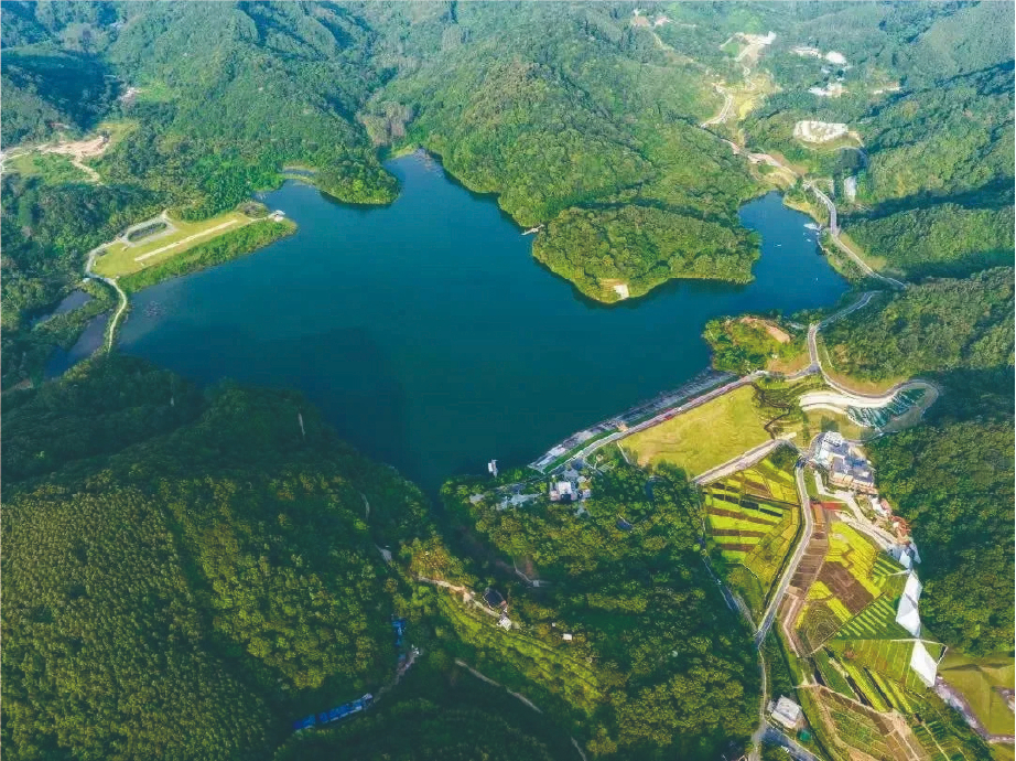
Automated Multi-Dockers for Remote Sites Monitoring
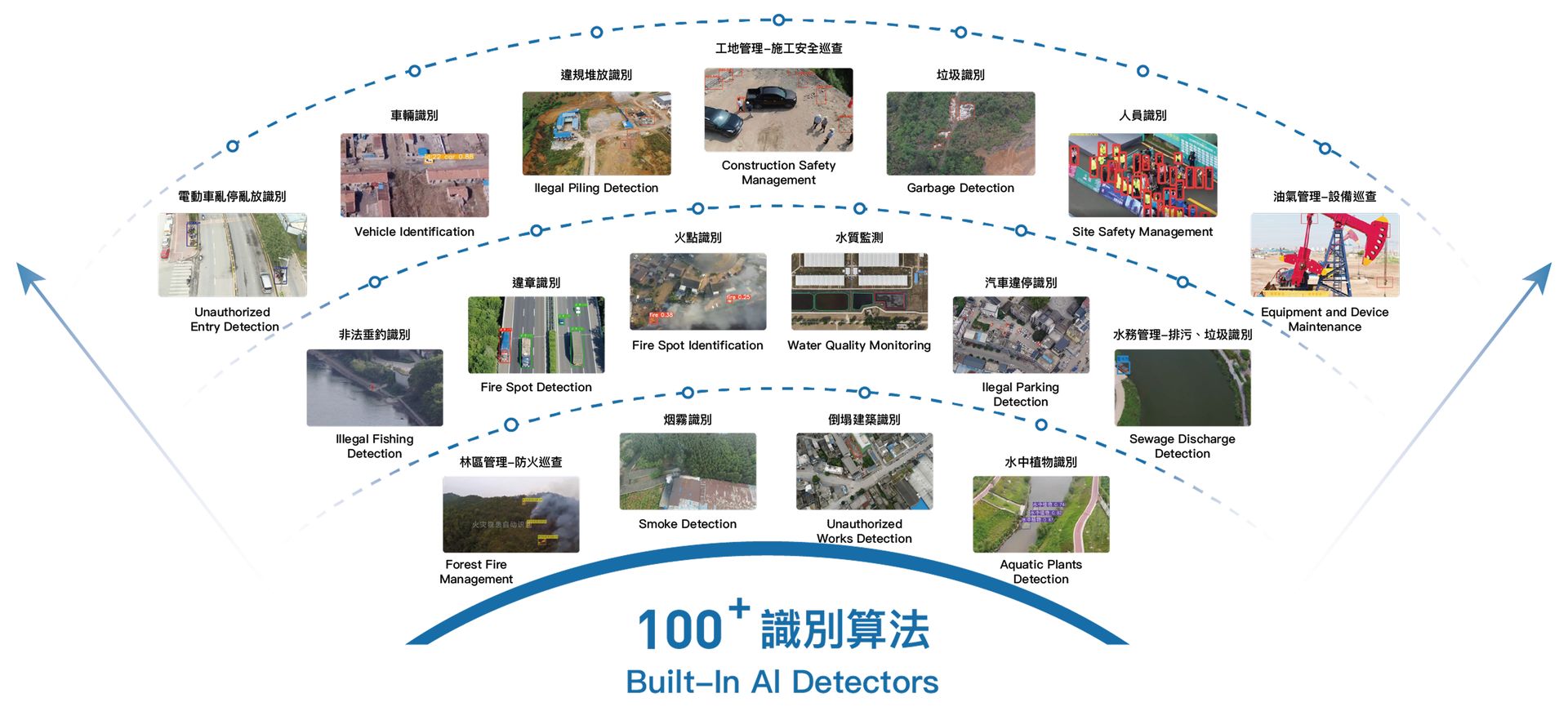
By forming an inspection network with multiple automated drone airports, it is possible to achieve full coverage of remote areas. Set and allocate task plans for each airport, and automatically execute inspection tasks in different zones. High-precision orthophotos and 3D topographic maps can be updated continuously and at a high frequency. Utilize artificial intelligence to detect ground targets, analyze changes, and promptly identify changes in land occupation. Monitor indicators such as water levels, water quality, and vegetation health, and assess disaster situations. This enables more efficient management of large-scale infrastructure such as suburban parks and reservoirs.
Implementation Case