Data Acquisition Hardware for
Complete 3D Production
The XGRIDS Lixel Series hardware systems convert spatial data into actionable digital assets through specialized capture technology and processing software.
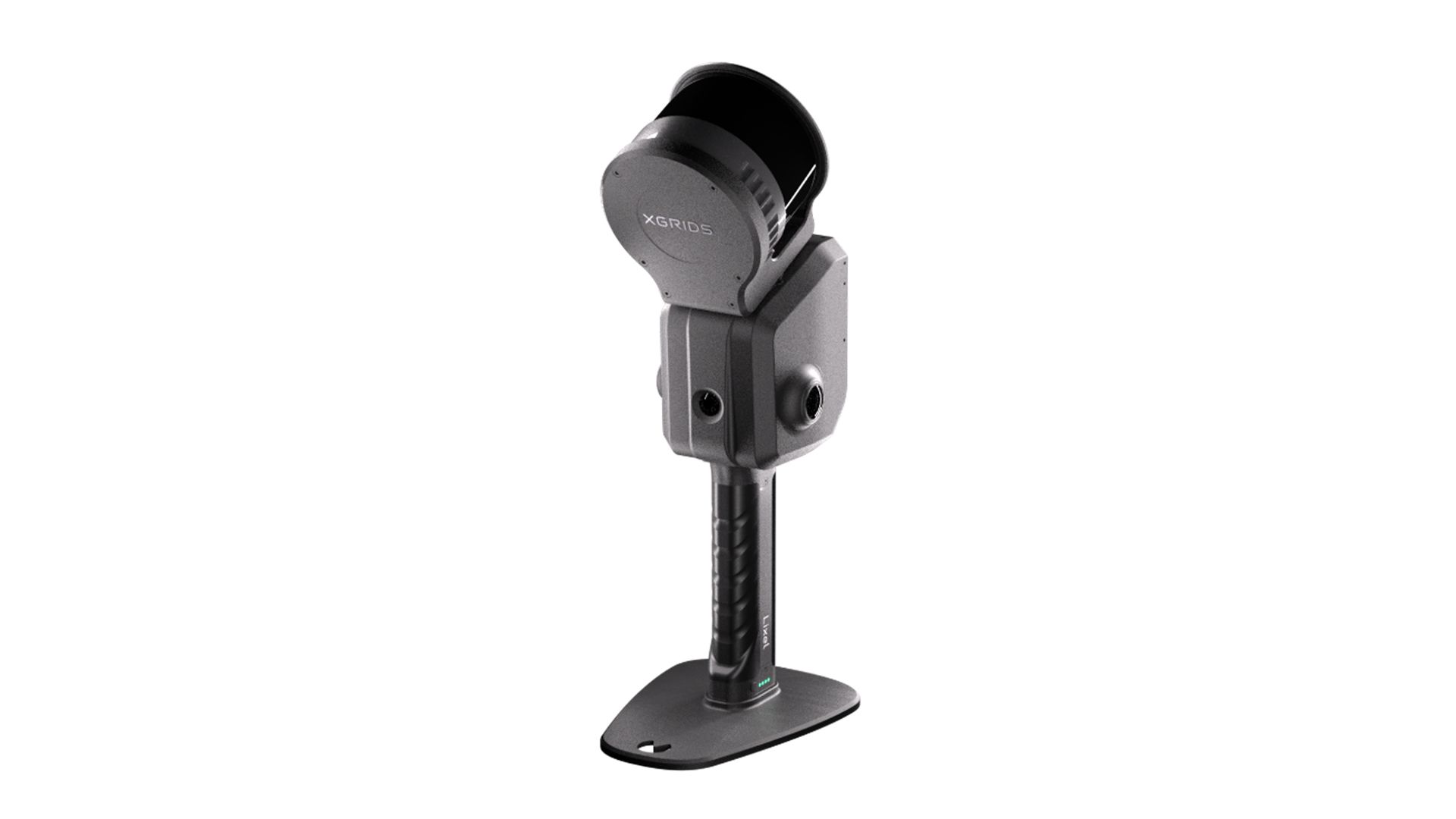
Lixel L2 Pro
High-Precision Real-Time 3D Modeling Device
· Post-processed quality data generated in real-time
· 1 mm precision point clouds
· Instant verification maximizes field productivity
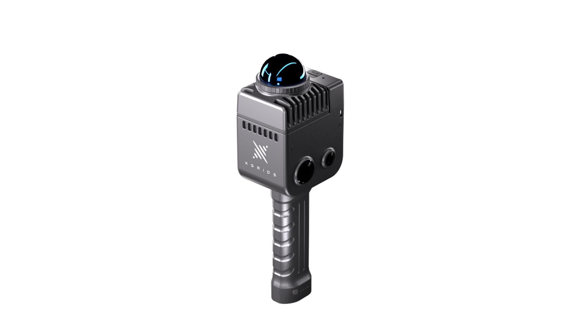
Lixel K1
Compact Handheld 3D Scanning Device
· Ultra-integrated hardware
· Scan by simply walking
· Pro-level results without expertise or premium costs
Product Comparison
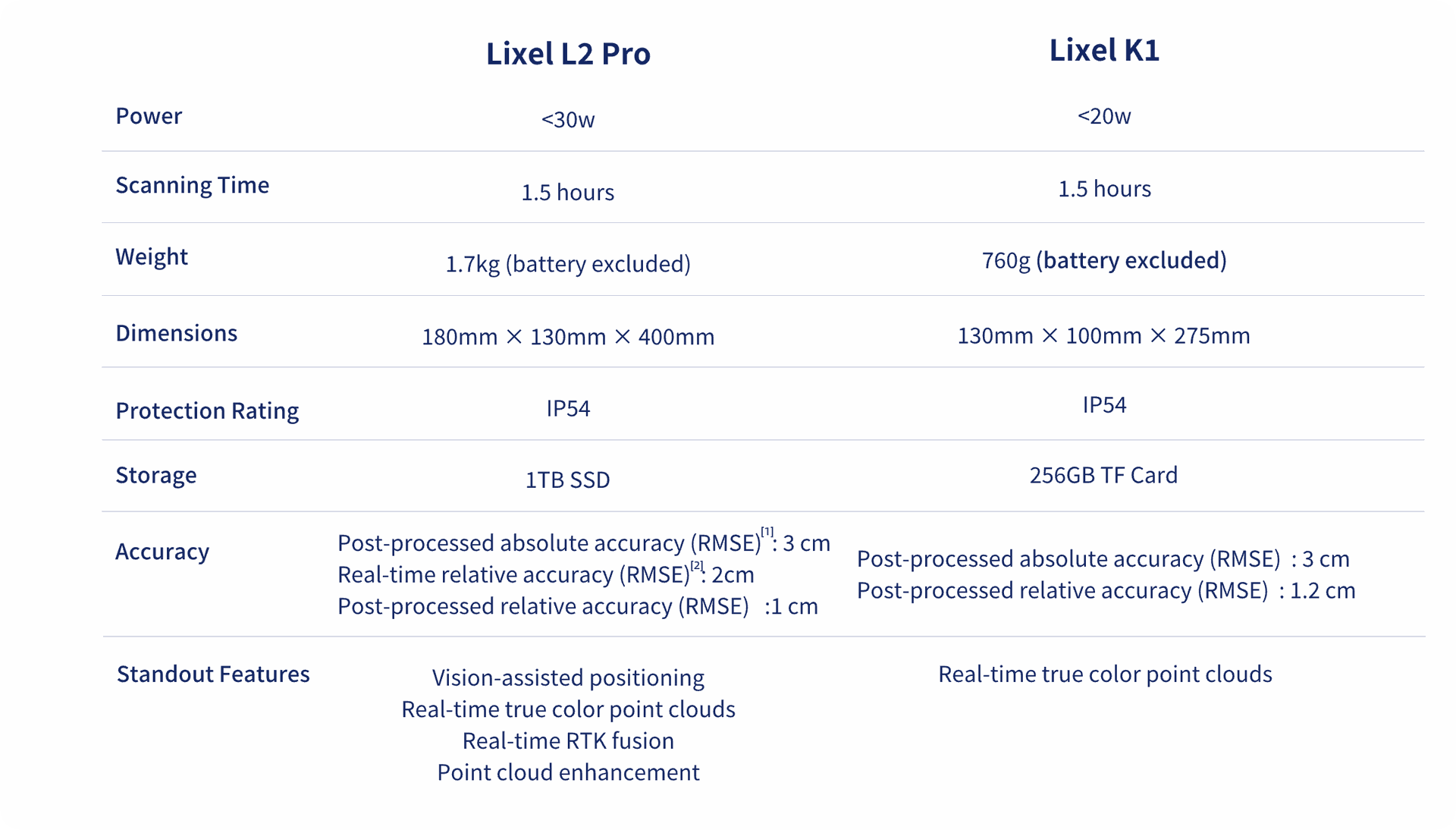
[1] RTK distance <100m or control point distance <100m;
[2] Distance between two points <100m
[3] RTK distance <50m or control point distance <50m