Industry Applications
Building Scalable Geospatial Solutions for Smart Infrastructure & Resource Management. We deliver custom-built platforms integrating real-time spatial analytics, IoT sensor networks, and cloud-based mapping interfaces, empowering urban planners, environmental agencies, and logistics enterprises with AI-driven decision support systems.
Technical characteristics
1. 100% domestically produced, fully self-developed and controllable
2. High-performance cross-platform rendering engine
3.Lightweight cloud data processing
4. BIM+GIS+IoT multi-source data integration
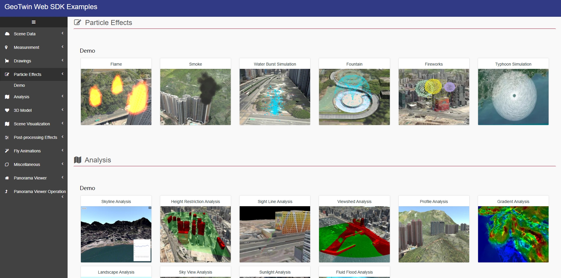
5.Configurable digital and analog separation visualization large screen
6. Dynamic optimization and acceleration of browser memory
Multi-Source Data Automatic Processing Tool
GeoTwin Engine is a powerful lightweight engine that can perform excellent lightweight processing on spatial data such as point cloud data, BIM data, 3D model data, oblique photography and images. GeoTwin Engine can support lightweight processing of massive city-level model data. By using technologies such as LOD, triangle mesh simplification and texture compression, the lightweight model can retain the main features while greatly improving the loading and rendering efficiency, making the application of twin scenes.
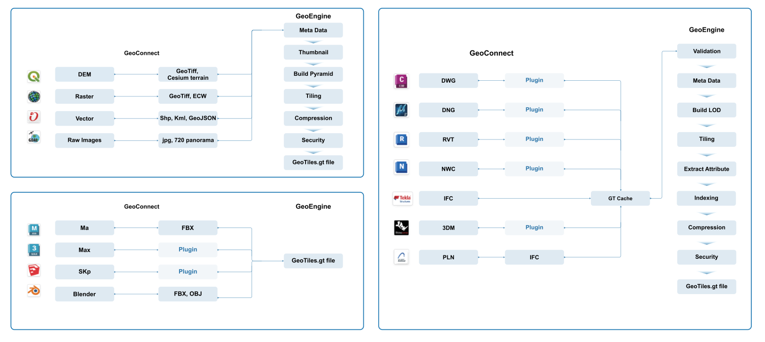
Provide models in both online and offline channels Lightweight method
Supports point cloud, BIM, tilt, image and other mainstream formats
Realizes unified format storage of multi-source data, and supports conversion to public formats
Retains the spatial characteristics and attributes of the original data
GeoTiles Format
GeoTwin Tiles format is GeoTwin's innovative spatial data storage and publishing format, which supports multi-source data fusion, provides multiple security mechanisms, and supports higher data compression and performance optimization technologies.

Compact file format
Saves storage space and facilitates data version management and replication,
Higher compression texturing capabilities
While ensuring the data quality, the texture map of the 3D model can be compressed to a smaller size
Deeper performance monitoring
You can gain deeper insight into GeoTwin Server performance by accessing speed controls and statistics
Geodisk I/O read and write
GeoTiles often require high disk read and write capacity. Using the GT format can reduce disk requirements,
Enhanced security
Add passwords to GeoTiles files and encrypt GeoTwin Server services to implement cross-domain usage restrictions
Open data conversion capabilities
GeoTiles can be converted back to Cesium 3DTiles, Potreetiles, GLTF and other OpenData formats
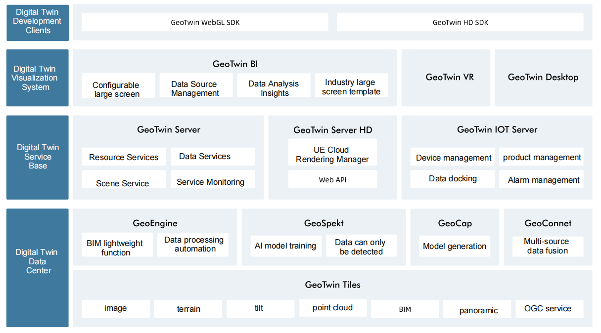
GeoTwin Server
GeoTwin Server is the foundation of the GeoTwin spatial twin computing platform. It is responsible for the comprehensive management of projects, data, resources, users and other information in the platform. It is specially used to edit, publish and manage geospatial data, and provides users with rich geographic information services. With efficient data service capabilities, flexible configuration options and strong scalability, it is an ideal choice for spatial data sharing and application.
Realize multi-user and multi-project management capabilities to meet the needs of multiple project construction
Create high-performance, high-concurrency and high-availability spatial information services based on microservices
Provide full-process management of file management, resource publishing, scene construction and data sharing
Provide data encryption protection mechanisms from storage, transmission to terminals to ensure your data security
GeoTwin IoT Server
GeoTwin IOT Server is the dynamic data management module of GeoTwin spatial twin computing platform, which can realize customized configuration of equipment types, equipment attributes and equipment general data exchange interface, customized equipment alarm level, trigger rules and sending objects, and can perform equipment positioning, equipment layout, heat map analysis and other functions based on digital twin scenarios.
Supports comprehensive device management and data monitoring Functions
Flexible and convenient monitoring data and service interfaces Low-code settings
Provide customized alarm levels, trigger rules and sending object settings
Device positioning based on digital twin scenarios And spatial analysis functions
GeoTwin WebGL SDK
GeoTwin WebGL SDK is a key component of GeoTwin spatial twin computing platform. Based on WebGL/WebGPU technology, it provides developers with a set of powerful, easy-to-use and highly scalable 3D graphics rendering and interactive control development clients. Through GeoTwin WebGL SDK, developers can easily build realistic and interactive 3D scenes, providing strong development support for applications in smart cities, digital twins, virtual reality and other fields.
Highly realistic visualization and physical simulation, spatial calculation and interactive control capabilities are provided
Based on the optimized scheduling technology of browser cache, it has efficient rendering performance
Rich API interfaces simplify the development process and improve development efficiency
Seamless integration of multiple mainstream development frameworks