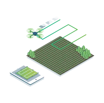
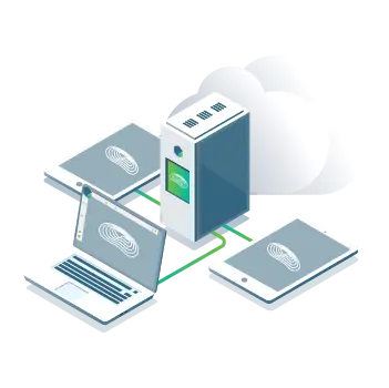
Data Acquisition
Capture imagery using drones with any RGB camera or compatible multispectral cameras like Parrot Sequoia+ and MicaSense RedEdge.
Use our Pix4Dcapture app to effortlessly plan and control drone flights for optimal mapping results.
Processing
With the real-time image processing engine, obtain mapping results directly on-site: 6.8GB, 2,948 images processed in just 10 minutes (using the new radiometric module).
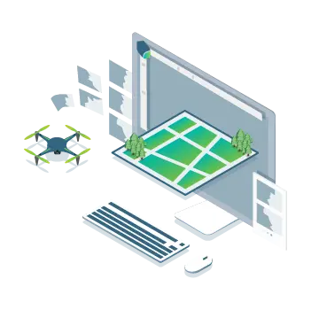
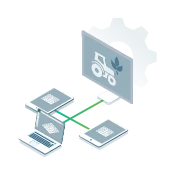
Field Monitoring
Generate high-precision orthomosaic maps, digital surface models (DSM), index maps, zoning maps, and prescription maps. Delineate field boundaries to create targeted agricultural outputs.
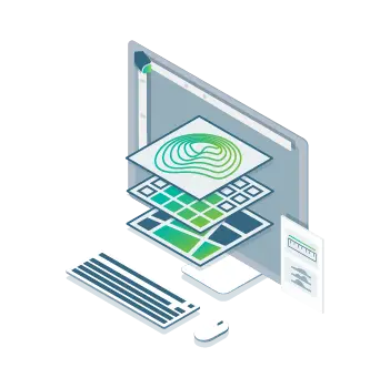
Analysis
Visualize and assess plant growth stages and stress levels. Analyze and compare multi-layer data to ultimately enhance crop yield and reduce cultivation costs.
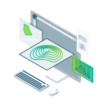
Share
Use Pix4Dfields' PDF reporting tool to seamlessly collaborate by sharing your maps with all project stakeholders.
Integration
Export results in industry-standard formats and seamlessly import them into your preferred farm management software.
Precision Agriculture Mapping with Drone Imagery
Powered by years of scientific research, our unique digital farming software delivers unmatched accuracy while dramatically reducing processing time

On-Site Results
Instantly generate maps (offline-capable) to enable real-time decision making without leaving the field.

Reliable Mapping
Get consistent field and crop maps—regardless of satellite availability or cloud cover—exactly when you need them.

Trusted Results
Eliminate guesswork in crop health analysis with calibrated multispectral or RGB imagery for quantified insights.

Share Results
Seamlessly connect your data to leading farm platforms like John Deere Operations Center. One-click synchronization enables instant access across all devices, anywhere.
Visualize, Inspect & Analyze Year-Round Crop Evolution
Rapid Mapping
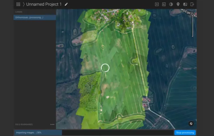
Process images in minutes—anywhere, offline—with Pix4Dfields' real-time engine.
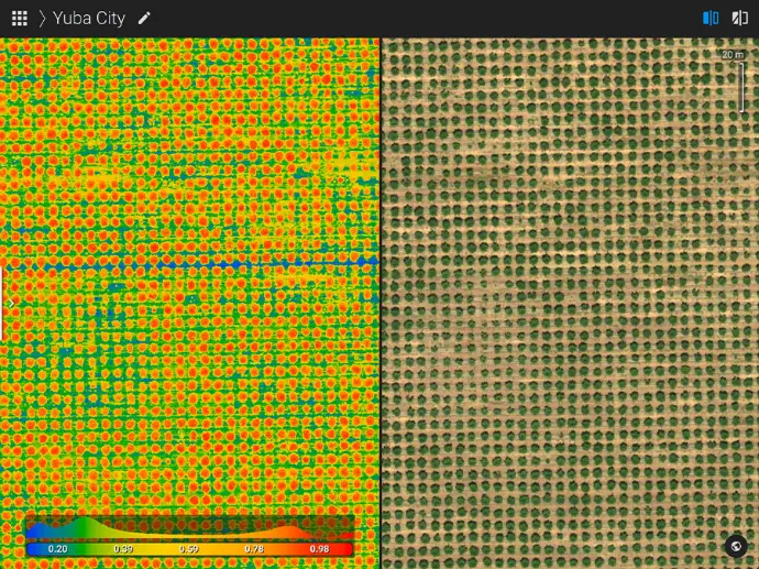
Vegetation Index Generation
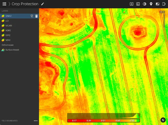
Utilize predefined agricultural indices or create custom formulas to precisely analyze plant stress levels.
Zoning & Prescription Mapping
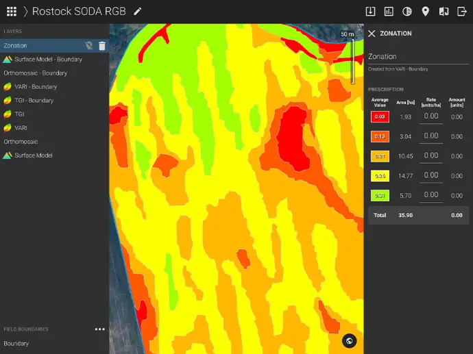
Transform vegetation index data into actionable management zones with variable-rate application (VRA) prescriptions.
Compare
Comparison & Annotation
Remotely inspect projects with precision—pinpoint, highlight, and document critical elements across datasets.
Measure & Annotate
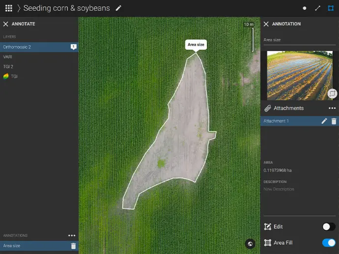
Add notes and perform measurements in key areas.
Export PDF Reports
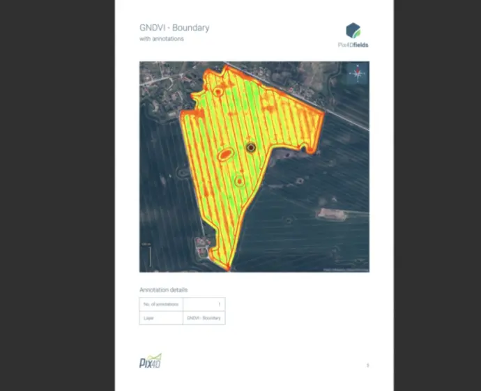
Share your maps seamlessly with all project stakeholders using Pix4Dfields' PDF reporting tool for collaborative workflows.
Aerial Imagery – Revealing the Invisible
Supports standard RGB and select multispectral drone-captured imagery

RGB

Modified

Specialty Cameras

Multispectral
Create & Analyze Real-Time Crop Maps
Streamline workflows with instant field intelligence
Orthomosaic Maps
Field Boundaries
Index Maps
Digital Surface Models (DSM)
Zoning Maps
Prescription Maps