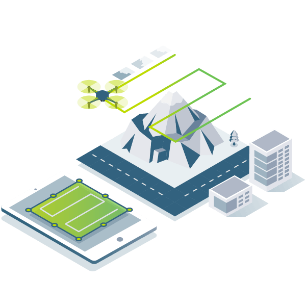
Acquisition
Capture RGB, thermal imaging, and multispectral imagery using any camera. If you're using a drone, pair it with the free PIX4Dcapture app to enable automated flight missions and seamless image data transfer.
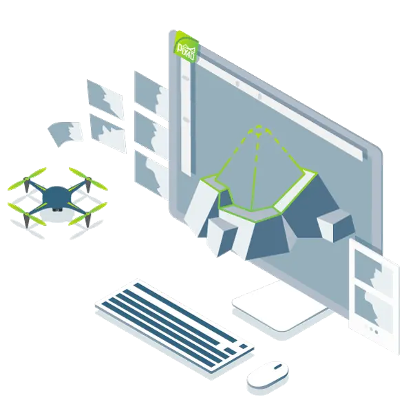
Digitalization
Pix4Dmapper transforms your images into digital spatial models. Seamlessly process your projects on either the desktop or cloud-based photogrammetry platform.
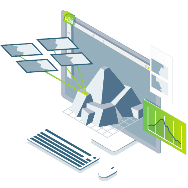
Control
Evaluate and enhance project quality.
The quality report offers a preview of the results, details of calibration, and additional quality metrics.
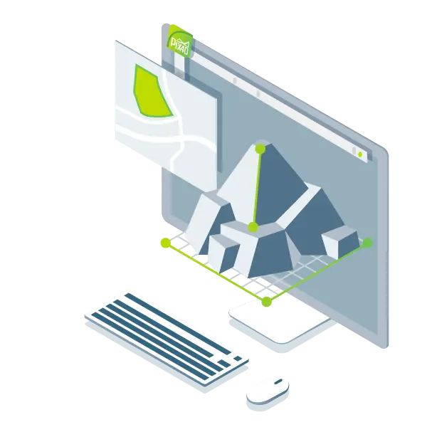
Measurement
/ Inspection
Measure distances, areas, and volumes. Extract elevation profile data and conduct virtual inspections.
Collaboration
/ Sharing
Streamline project communication and teamwork. Share data analysis results securely and selectively with your team, clients, and suppliers in standard file formats.

Multi-tool solutions for cross-industry applications
Desktop and cloud

Survey-grade accuracy
Achieve sub-centimeter precision. Planimetric accuracy: 1-2×GSD. Elevation accuracy: 1-3×GSD.
Full project control
Customize processing areas, select processing options, add ground control points, and edit point clouds, DSMs, 3D textured models, and orthomosaic maps.

Flexible workflow
Process automatically using default templates or fully control data, projects and quality with customizable options.
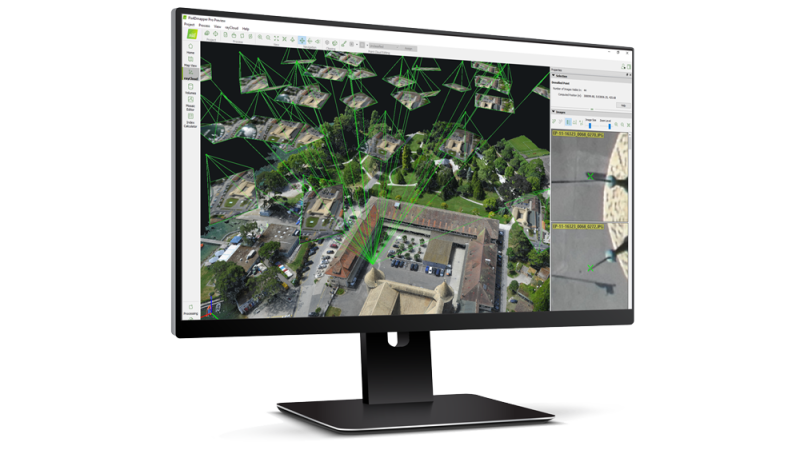
rayCloud™
The Power of Photogrammetry
A unique interactive environment that connects any point in 3D reconstruction with its original imagery for intuitive accuracy verification and project enhancement.
Vision-based high-precision maps and models
Automated point cloud classification
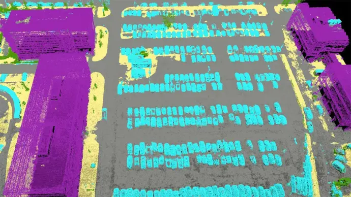
Machine learning algorithms for object differentiation.
Flatten / smooth surfaces
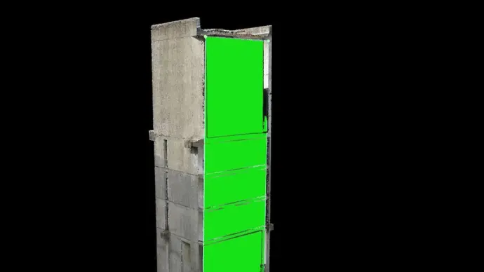
Create planes to flatten areas or fill voids.
Easily measure area, distance, volume and elevation
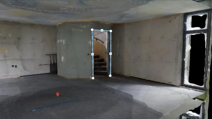
Conduct measurements in 3D environment using adjustable reference planes
Detection / Annotation
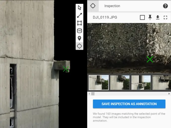
Perform remote project inspection with precise positioning and labeling of key elements.
Collaboration / Sharing
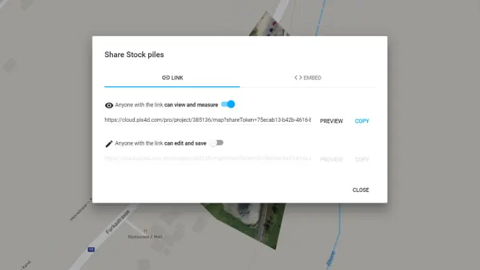
Securely share project data and analysis results with teams, clients, and suppliers.
Supports any imagery
Any camera, any drone, any image. As long as it's .jpg or .tif.

Write something...
RGB imagery
Drone imagery
Multispectral imagery
Thermal imaging
Fisheye lens imagery
360° camera imagery
Camera array imagery
Video footage


Generate multiple output formats
Export maps and models in various industry-standard formats for further analysis or reporting.
Full-color point clouds
.las,.laz,.ply,.xyz
Orthomosaic maps
GeoTiff(.tif),. kml
Digital surface models (DSMs)
GeoTiff(.tif),. xyz,.las,.laz
3D textured models
.ply,.fbx,.dxf,.obj,.pdf
Index maps
GeoTiff(.tif),. shp
Heat maps
GeoTiff(.tif)