Data Acquisition
Capture images or point clouds using drones or laser scanners
Download our free PIX4Dcapture app
Plan automated, optimized flight paths for drones

Data Import
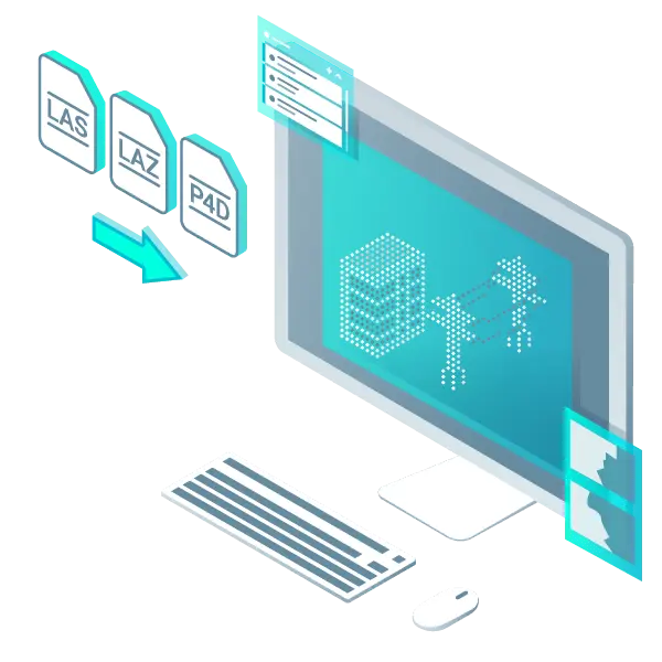
Import data from other PIX4D software into PIX4Dsurvey, or directly load .las/.laz files. Merge multiple datasets into a single project.
PIX4Dsurvey processes both image-based and laser-scanned point clouds simultaneously.
Vectorization
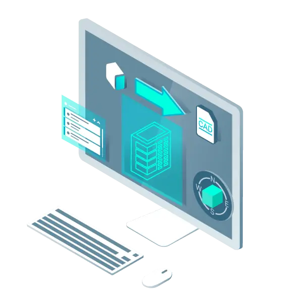
Extract key project elements in PIX4Dsurvey: Generate engineering-ready CAD vector files directly from point cloud data, and create TIN (Triangulated Irregular Network) surfaces for ground modeling.

3D Modeling
Transform lightweight point clouds into terrain models using intelligent point meshing, TIN generation, and terrain classification tools to achieve precise modeling results.

Seamless Integration
Data generated in PIX4Dsurvey is fully compatible with all major CAD and GIS software platforms, ensuring smooth integration into your existing workflows.
Unlocking Point Cloud Value
Extract key features to simplify and accelerate the drafting process

Efficient Vectorization
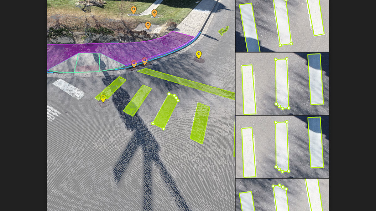
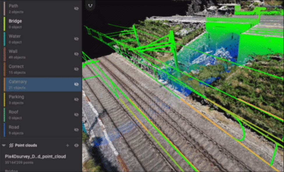
Extract key features (road edges, building outlines, fences, catenary wires) from photogrammetry/LiDAR data using combined image and point cloud processing.
Save Time
Vectorize in point clouds and verify with original images, increasing efficiency by 50%. Smart point meshing saves 1,000+ clicks when creating elevation points.

Seamless CAD Integration
Export projects as vector files with layers and attributes for smooth CAD/GIS transfer, significantly reducing file size.

Volume Measurement
Quickly and easily create and measure volumes of any object, even when positioned against walls or in corner areas.
Extract Key Elements Using 3D Data
Built-in Vectorization Tools
Easily vectorize projects with just a few clicks using point, polyline, polygon, and catenary tools.
Measure Volume
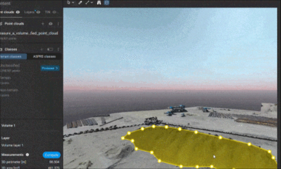
Calculate the volume of any object or space in just a few simple steps.
Create Terrain
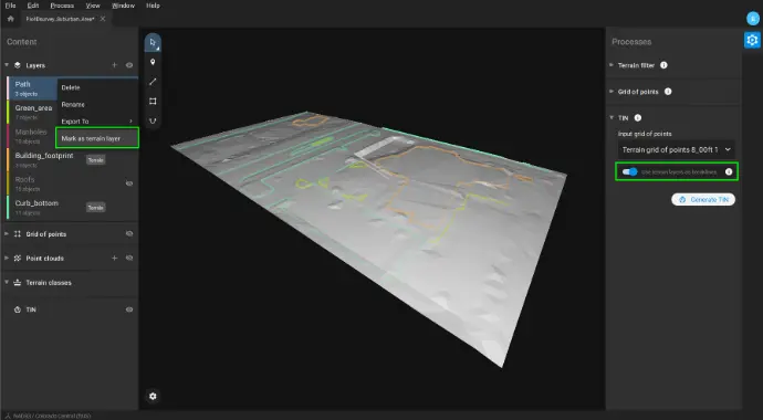
Generate TIN surfaces from points and breaklines to model the ground. Automatically create elevation points while significantly simplifying point clouds.
Unlock More Data
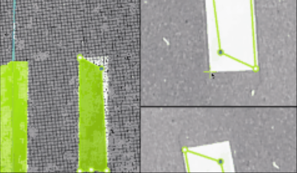
Go beyond photogrammetry—use Pix4D's rayCloud to access both original images and 3D point clouds simultaneously. Vectorize in 3D, refine edits in 2D. Measure complex objects visible only in source imagery. Select points by color and find similar-colored points within a defined radius.
Scale Up
PIX4Dsurvey handles billions of points effortlessly. Process unlimited point cloud files (including .las) within a single project.
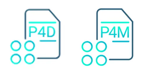
Integrated Solution
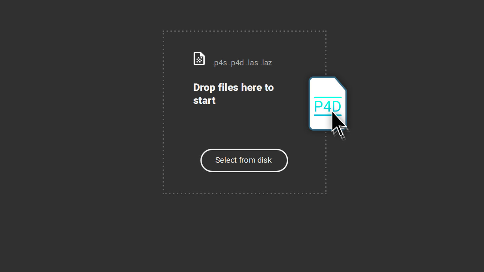
PIX4Dsurvey seamlessly integrates with your existing workflow. Import .p4d files from PIX4Dmapper, .p4m files from PIX4Dmatic, or .las/.laz files from any device/source with a single click.
Effortless Export
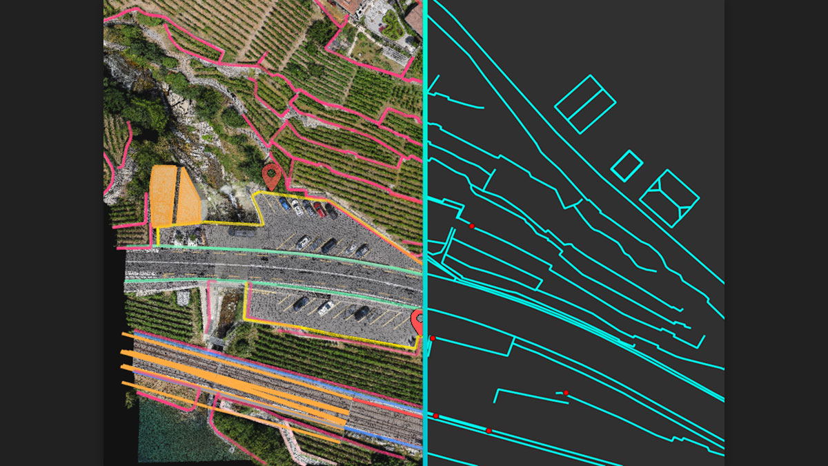
Assign each measured object to customizable layers, then export individually or collectively for seamless integration with your preferred CAD/GIS software.
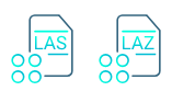
Point Clouds from Any Source
Import PIX4Dmatic/PIX4Dmapper project files or any .las/.laz format
Aerial Data Processing
Process drone imagery in PIX4Dmapper/PIX4Dmatic to generate point clouds, then drag & drop .p4d/.p4m project files directly into PIX4Dsurvey.
LiDAR Scanner Support
PIX4Dsurvey processes multiple .las/.laz point cloud files simultaneously