Ready for Bigger Data?
Smarter Software for Tomorrow's Surveying Challenges
Bigger Data, Precise Results
PIX4Dmatic processes thousands of images while maintaining survey-grade accuracy, dramatically reducing processing time—no project splitting or merging required.

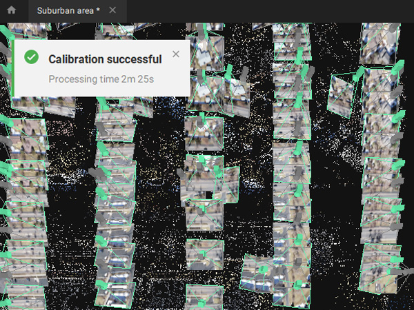
Fully Automated Processing
Co-developed with surveyors to streamline your workflow: Import, process, and evaluate project quality in just a few clicks—then seamlessly transition from PIX4Dmatic to PIX4Dsurvey.
Ground Modeling Workflow
Leverage the combined power of photogrammetry and LiDAR technology to process LiDAR and RGB imagery from PIX4Dcatch—enabling a complete, Desktop-based close-range ground modeling solution.
Generate Precise 3D Maps
Models from Thousands of Images
Fast Processing
PIX4Dmatic handles large datasets effortlessly, reducing processing time by up to 50% while maintaining survey-grade accuracy.
Simplified Accuracy Verification
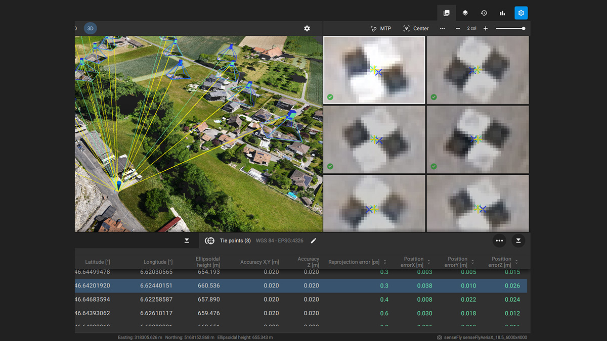
Ensure project precision using ground control points (GCPs), checkpoints, or manually placed tie points. Access comprehensive quality metrics through dedicated tie point tables and detailed accuracy reports.
Vertical CRS & Geoid Support
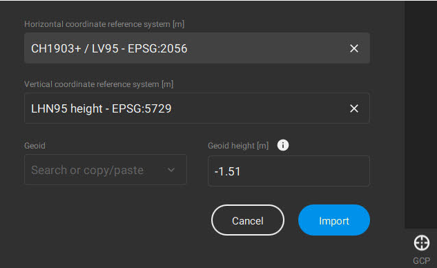
PIX4Dmatic supports industry-standard vertical coordinate reference systems (CRS) with integrated geoid modeling capabilities.
Import from PIX4Dcatch
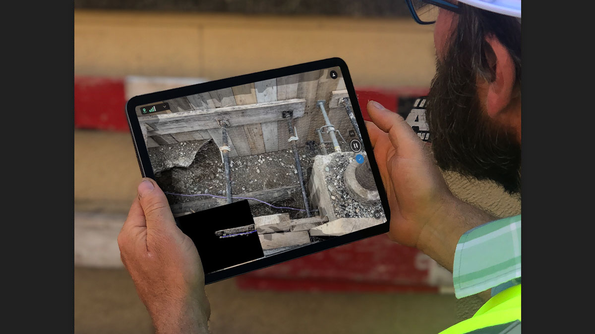
Process LiDAR point clouds and RGB imagery exported from PIX4Dcatch for integrated photogrammetric modeling.
Rapid Development Cycle
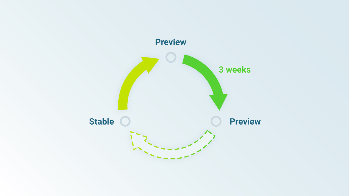
New preview or stable builds released every 3 weeks, delivering continuous improvements and cutting-edge features.
High-precision results in less time
Without sacrificing accuracy
Point Clouds
Generate dense point clouds, depth point clouds, or fuse both types as needed for your project.
Output Formats:.las
Orthomosaic Maps
Geometrically corrected and uniformly scaled, with color-balanced processing for visually seamless results.
Output Formats: GeoTIFF (.tiff)
Digital Surface Model (DSM)
A digital representation of all objects in the mapped area, including natural features and man-made structures such as buildings.
Output Formats:GeoTIFF (.tiff)
Textured 3D Models
Generate and extract photorealistic 3D mesh models with customizable texture resolution and decimation criteria.
Output Formats:.obj
PIX4Dsurvey Compatibility
Seamlessly export processed projects to PIX4Dsurvey for direct point cloud-to-CAD vector conversion.
Output Formats:.p4m