
Aerial Surveying Redefined
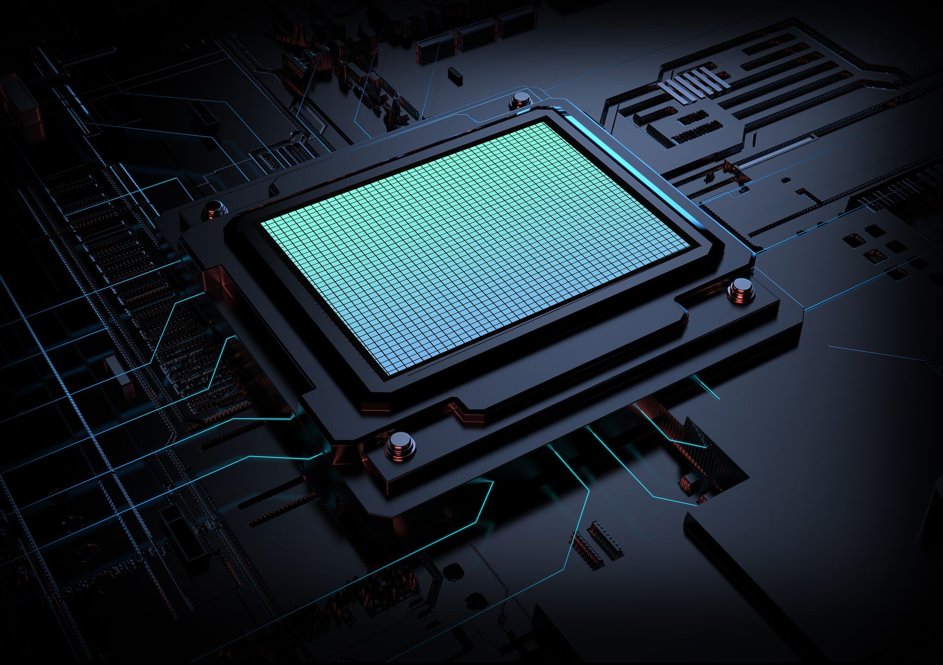
Self-developed full-frame imaging module delivers 45MP per sensor, achieving 225MP total resolution – redefining the possibilities of 200MP+ full-frame aerial cameras.
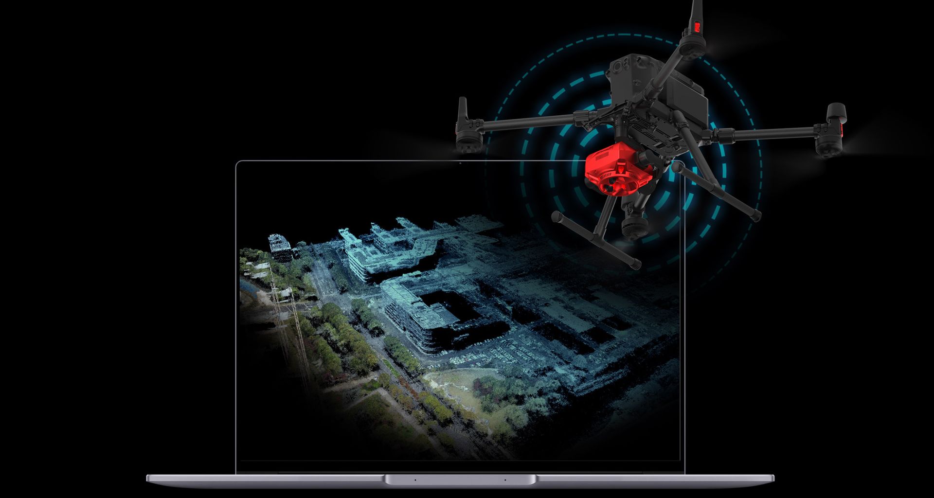
The Optimal Choice for Large-Scale Urban Projects
Leveraging its full-frame sensor advantage, the SHARE 202S PRO achieves a flight altitude of 272m while maintaining 3cm GSD for high-precision aerial surveying.
Fixed-Wing Operation Supported
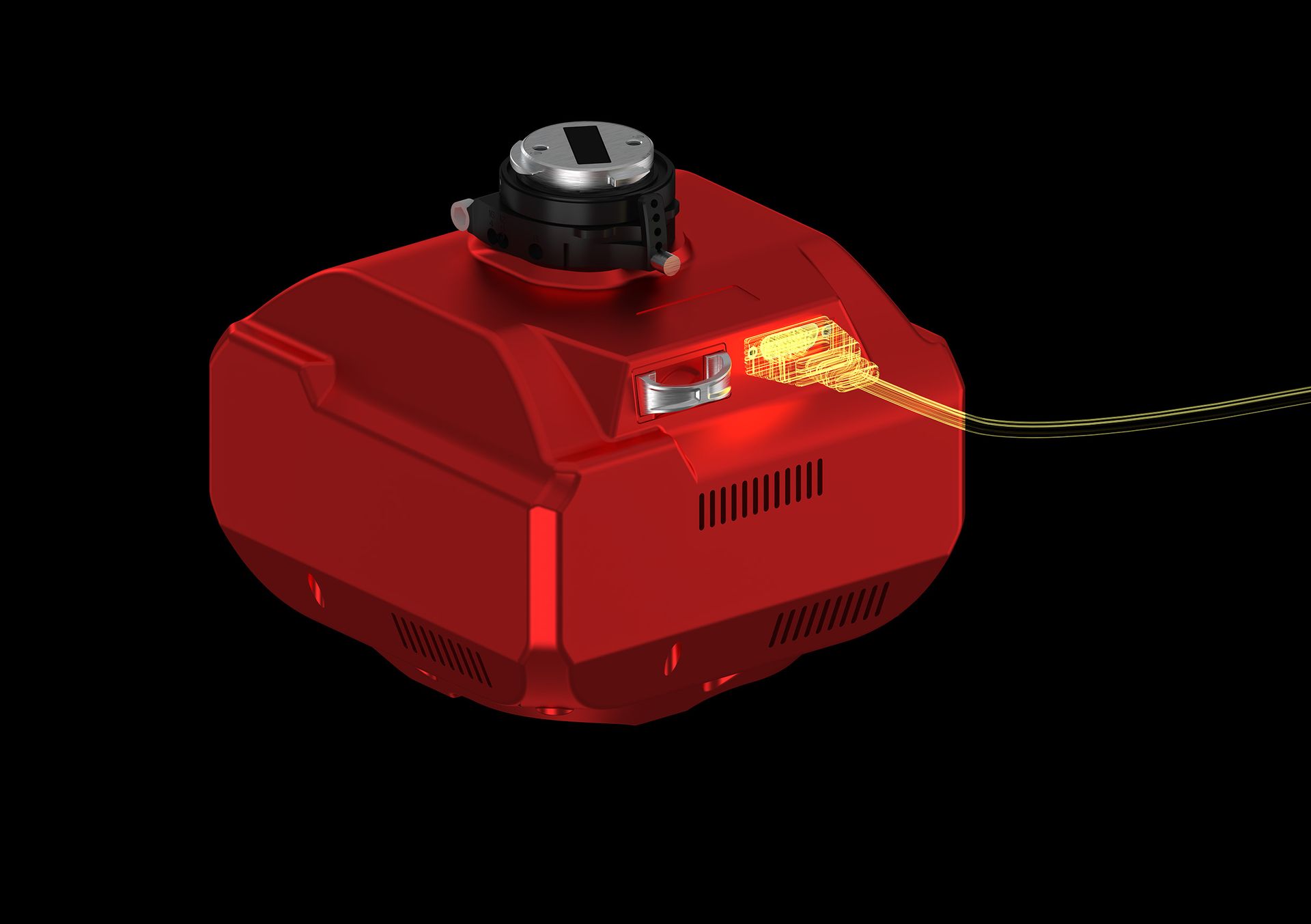
Standard equipped with DJI SkyPort interface and universal aviation connectors, it enables deep integration with fixed-wing aircraft, supporting serial communication, camera parameter configuration, live video transmission, ground control-free protocols, and full-featured secondary development adaptation.
500,000 Shutter Cycles
Featuring an upgraded S-GS global shutter for precise exposure without rolling shutter effects. With KIMOTO low-friction material, the shutter lifespan is significantly extended to 500,000 cycles.
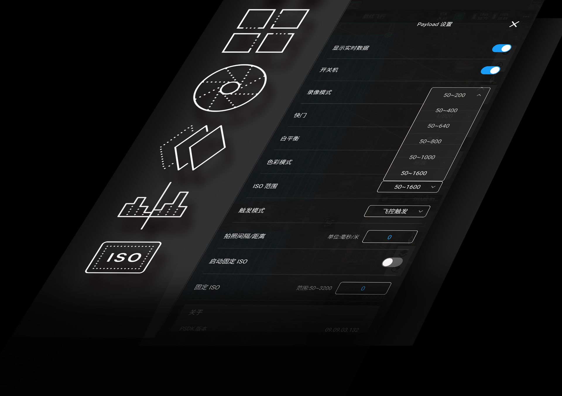
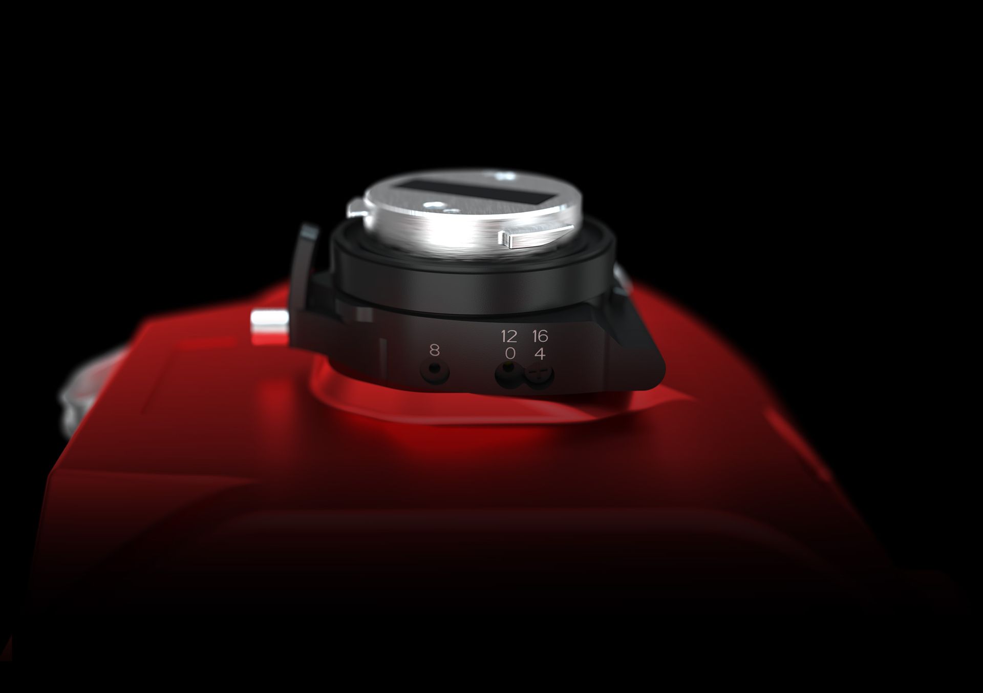
Parameter Adjustment Function
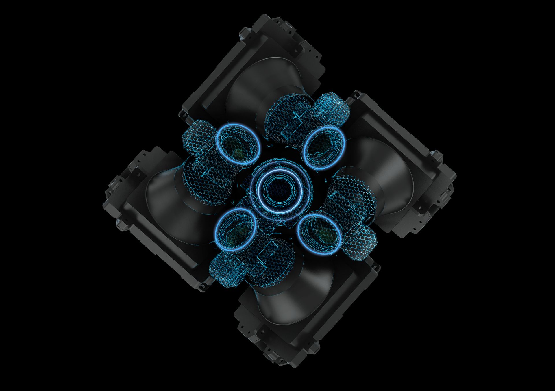
The downward-facing lens has a focal length ≥40mm, while the oblique-facing lens ≥56mm. Adjustable parameters include shutter speed (1/100~1/2000s), ISO, white balance, and color mode. Users can fine-tune these settings according to specific mission requirements.
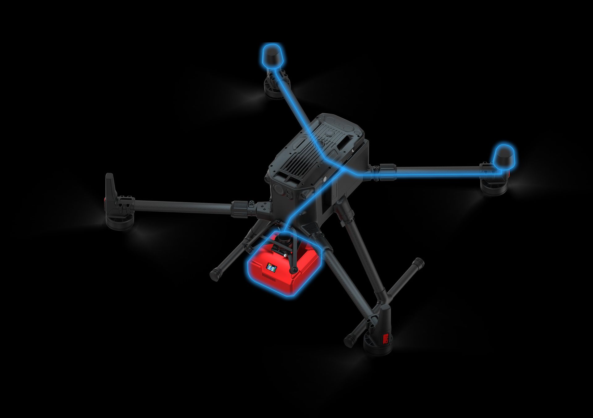
Ground Control-Free Operation
Powered by advanced TIMESYNC 2.0 technology, it achieves microsecond-level synchronization between camera, aircraft, RTK and flight controller. With POS data directly embedded in images, the system enables direct photogrammetric processing without pre-processing.
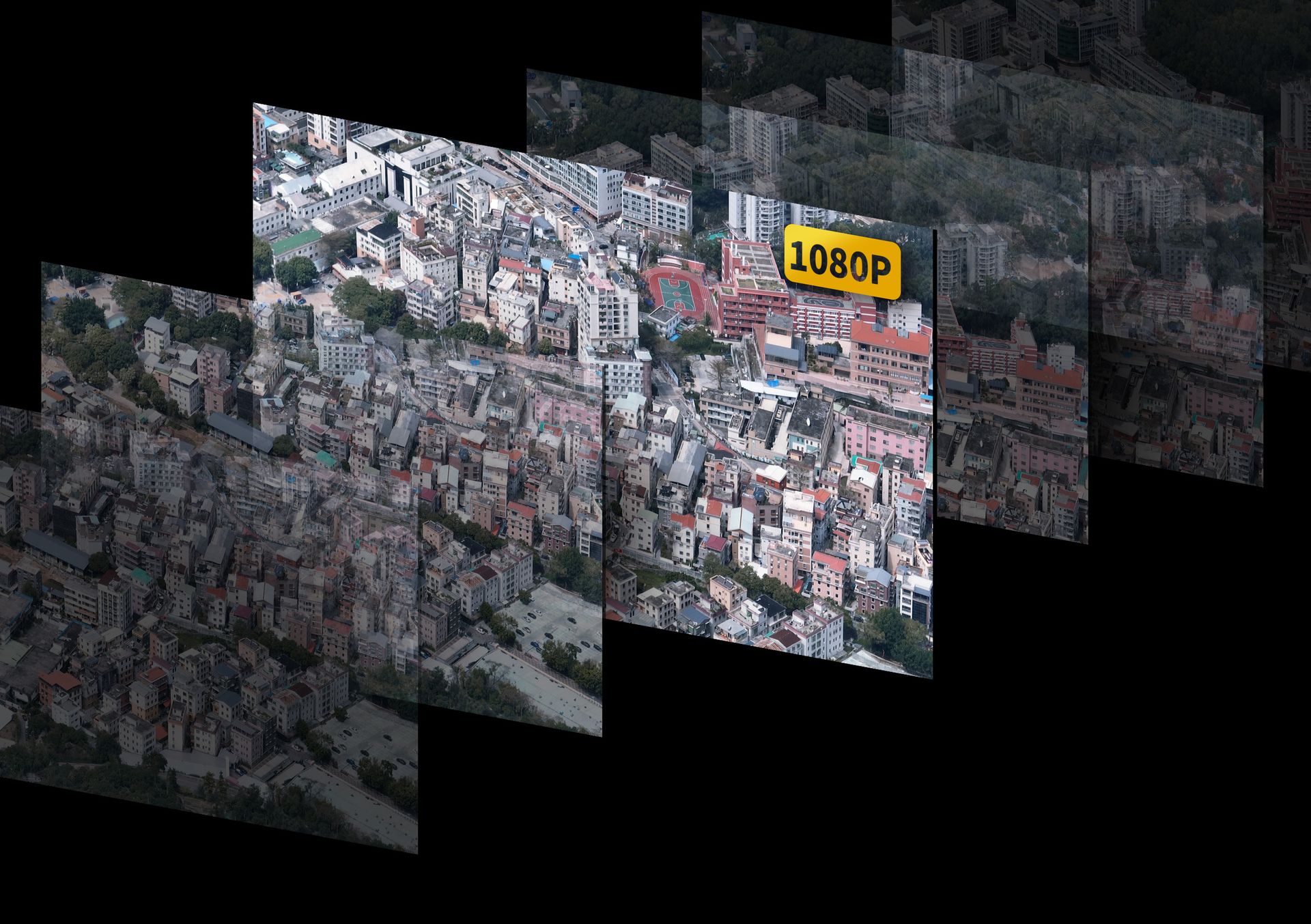
1080P Live Video Streaming Supported
The nadir camera supports real-time video transmission with adaptive bitrate control that automatically adjusts to operational range, ensuring uninterrupted signal. Simultaneously enhances UAV safety by monitoring landing terrain risks, effectively compensating for downward obstacle avoidance limitations.
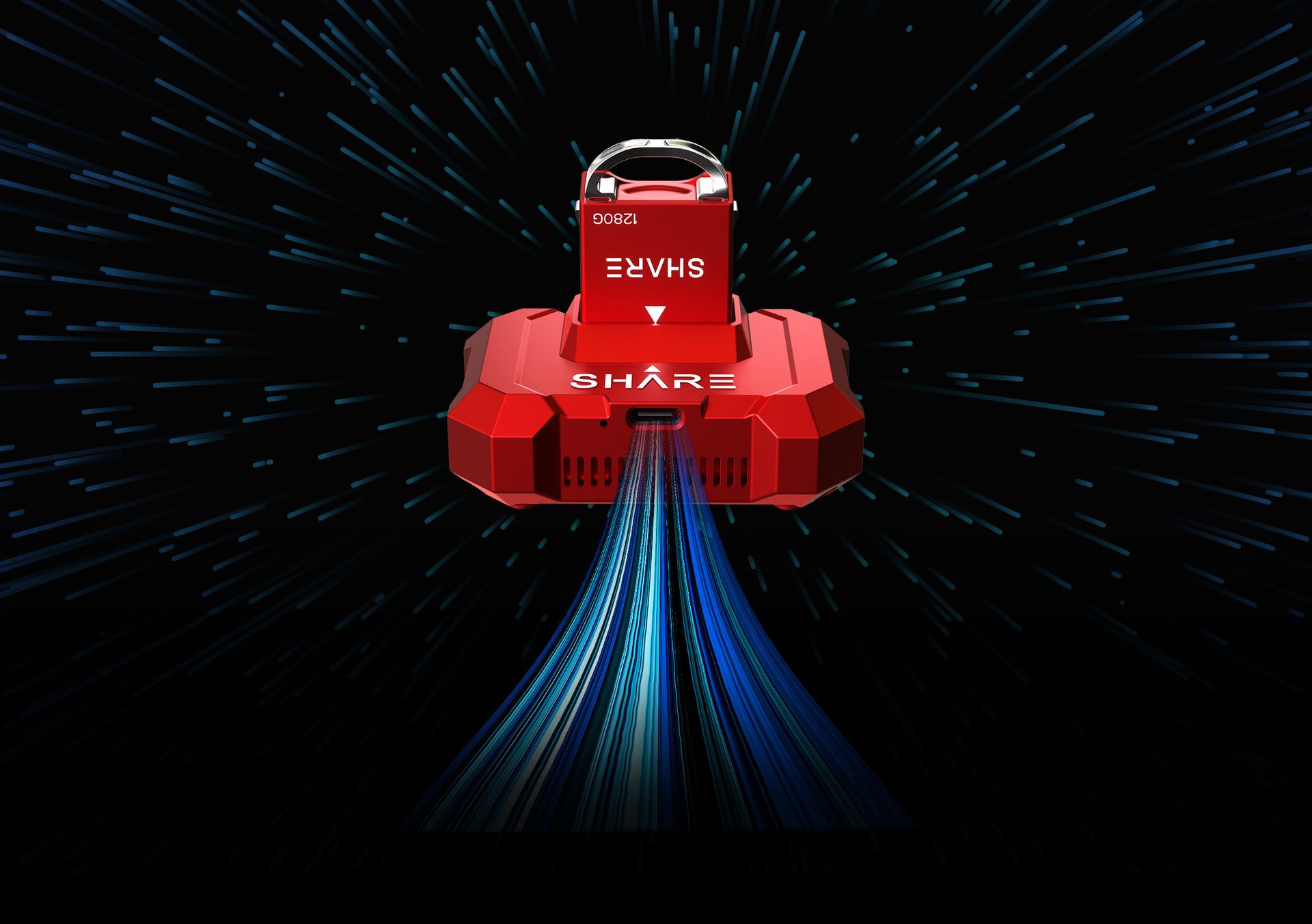
600MB/s Data Transfer Speed
Equipped with a standard 1280GB storage module for all-day operation, featuring hot-swappable functionality. The 600MB/s transfer speed significantly improves data handling efficiency.
Standard Angle Adjustment Mechanism
When mounted on rotorcraft for field data acquisition, the system automatically adjusts camera tilt compensation based on flight speed, ensuring perpendicular ground alignment during missions. Supports operations at speeds up to 15m/s.
Real-time aerial photo transmission for emergency mapping
Upgraded Gigabit Ethernet port significantly improves transmission speed. Supports real-time photo transfer to E-series onboard microcomputers, or data relay to ground command via satellite link, video transmission channel, and 5G network - ensuring emergency operation needs and rapid 3D model generation.