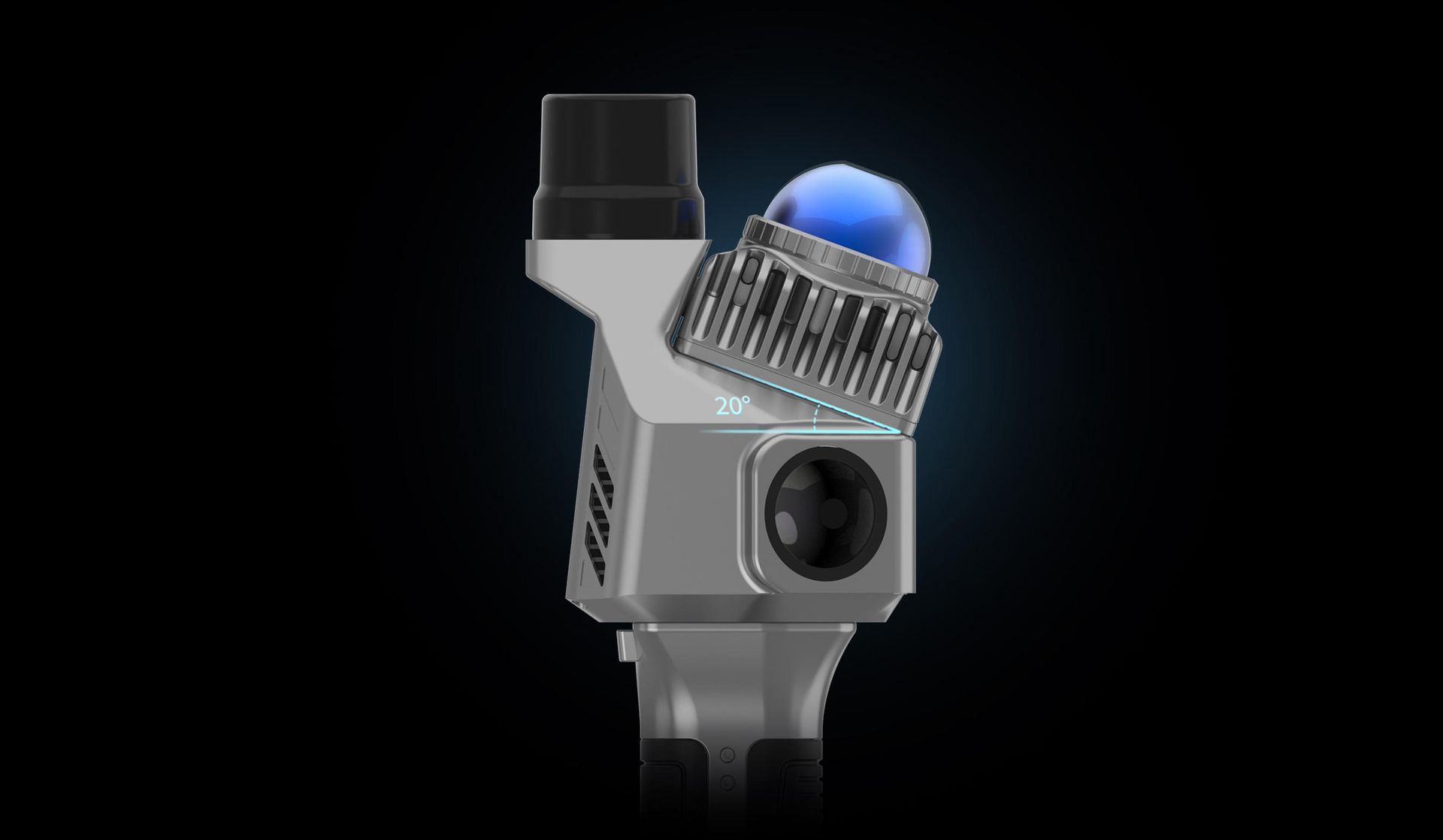
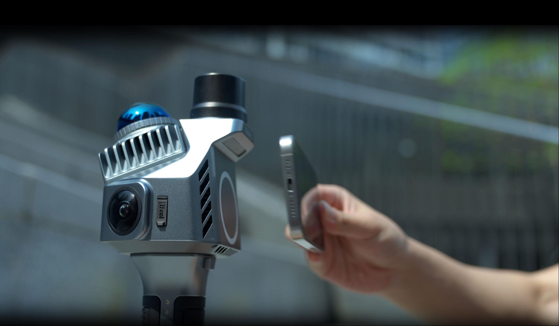
20° Tilt-Angle LiDAR Mounting
The LiDAR system employs a 20° downward tilt installation, enabling simultaneous coverage of ground surfaces, frontal obstacles, and ceiling structures. This configuration eliminates repetitive angle adjustments during operation, significantly enhancing single-scan efficiency.
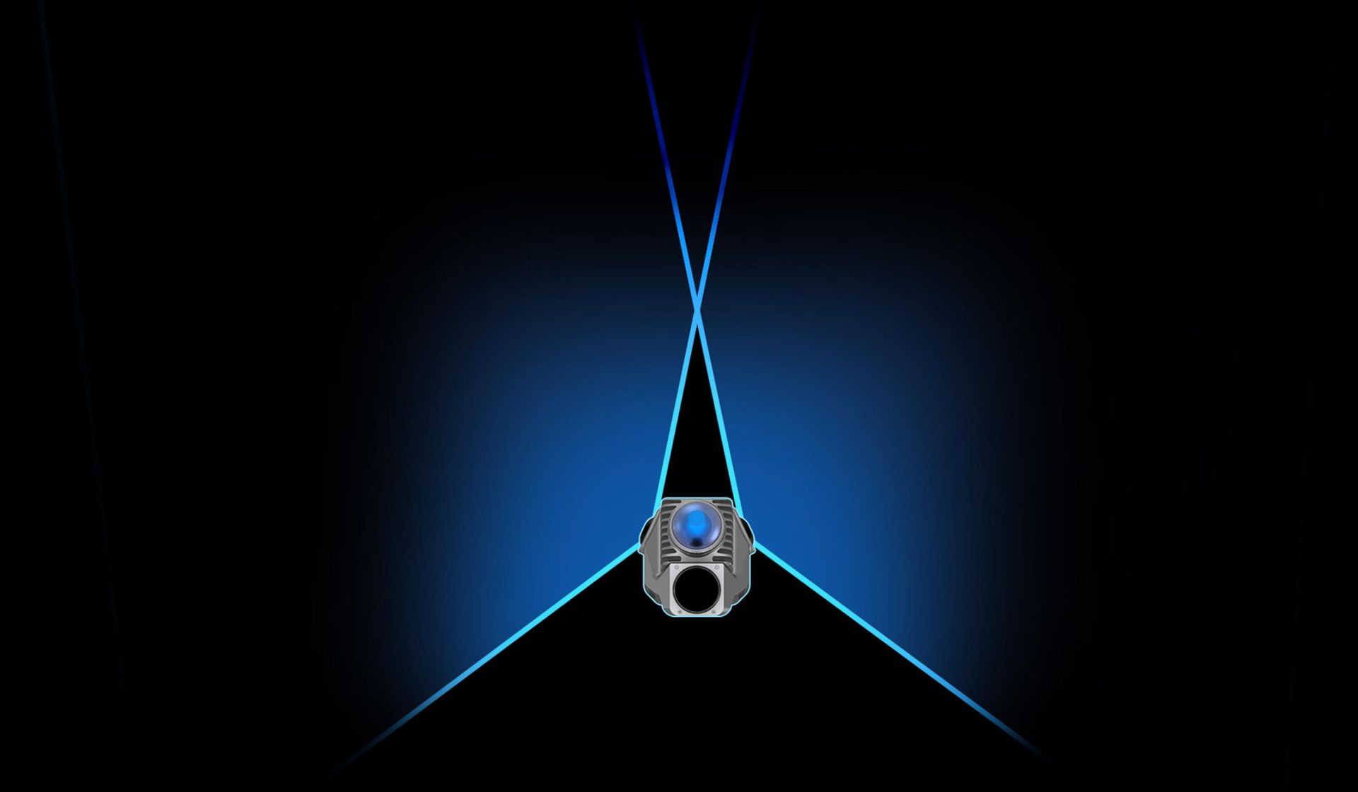
135° Dual-Camera Configuration
The system integrates two high-resolution wide-angle cameras (self-developed) in a 135° angular distribution, significantly expanding image capture coverage. This monolithic design eliminates alignment errors caused by disassembly/reassembly, while microsecond-level synchronization ensures precise color mapping.
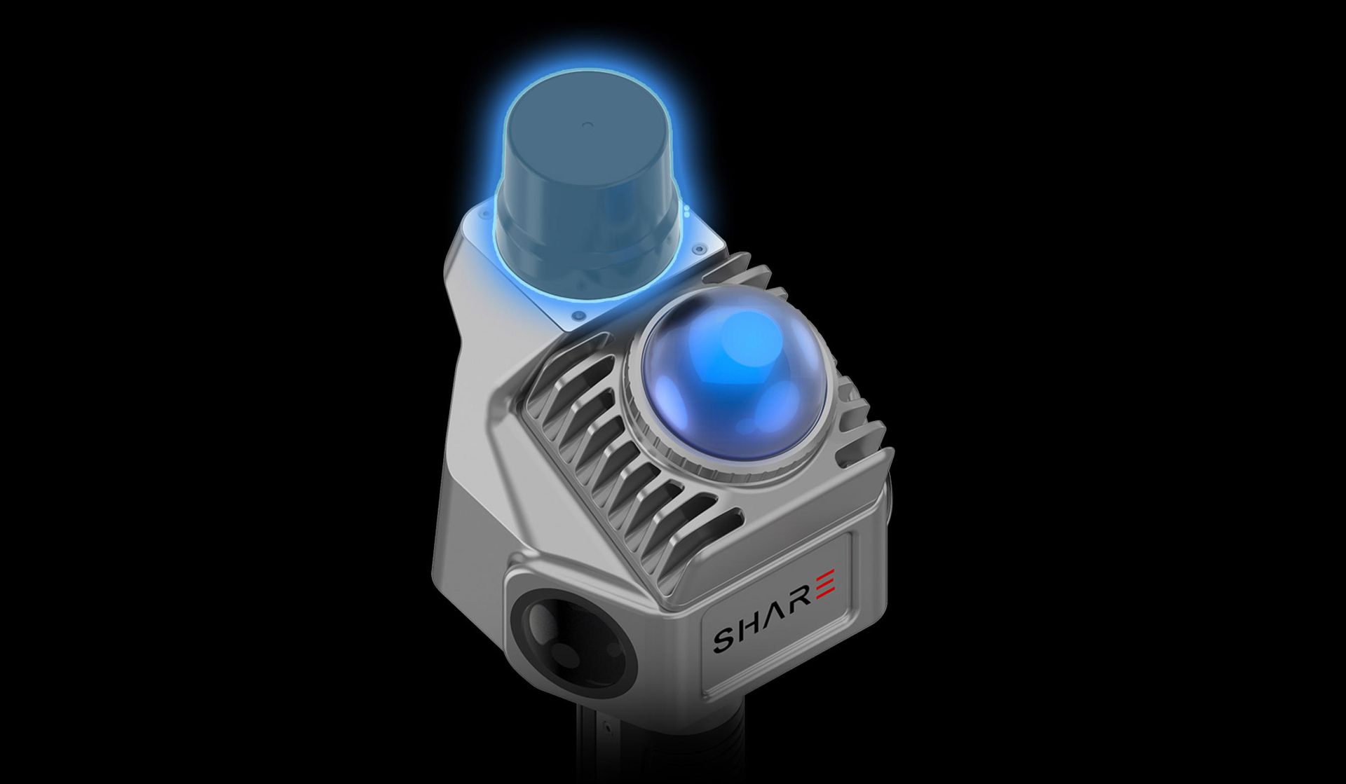
Integrated RTK Positioning Module
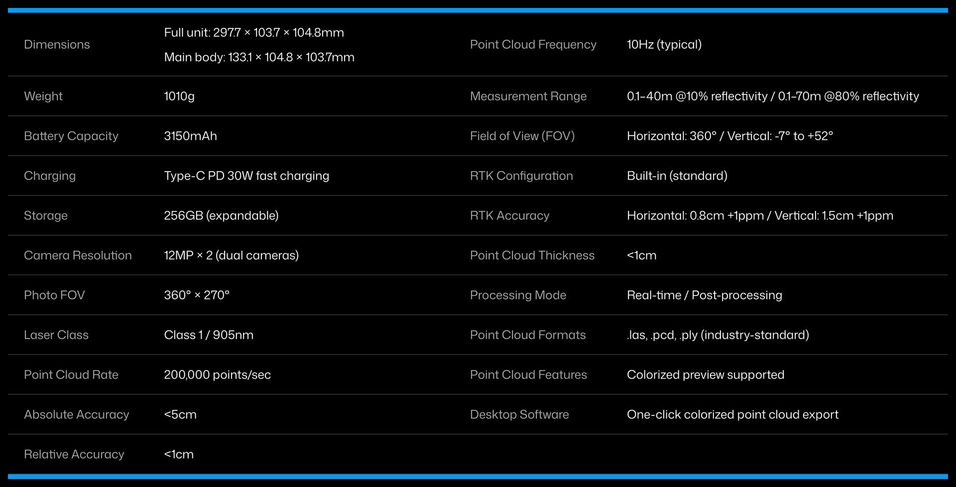
The SHARE SLAM S10 features a built-in RTK module as standard, eliminating the need for external attachments—simply power on for immediate use. This fully integrated RTK system achieves microsecond-level synchronization between core sensors (RTK, IMU, and cameras). Supporting 7 constellations and 21 frequencies, it delivers centimeter-level RTK positioning accuracy.
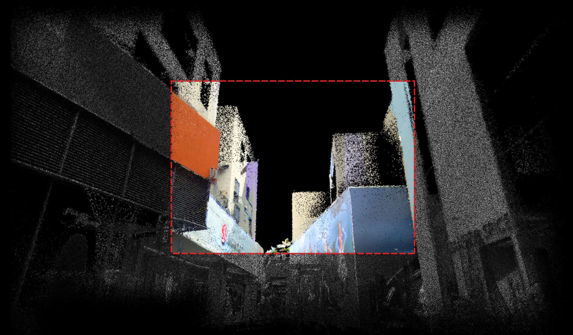
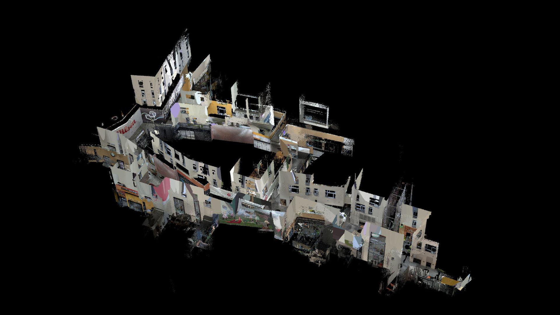
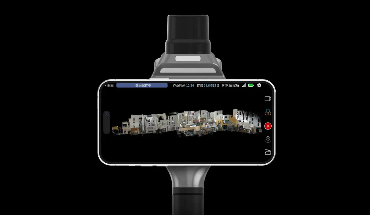
Real-Time Colorized Point Cloud Preview
Unlike external camera solutions, our system directly fuses LiDAR scans with synchronized camera imagery through an embedded high-performance processor. This enables industry-leading real-time colorized point cloud processing and preview by instantly processing massive point cloud and image datasets.
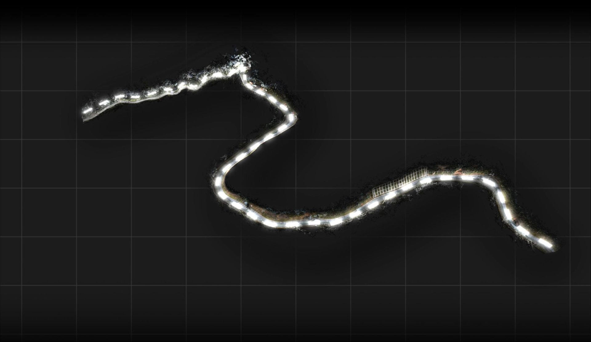
Closed-Loop-Free Scanning Operation
In RTK-stable environments, our proprietary fusion algorithm generates georeferenced point clouds without requiring loop closure, delivering absolute accuracy better than 5cm in a single pass.
Microsecond-level time synchronization technology
With self-developed camera imaging algorithms, point cloud-image fusion algorithms, and multi-sensor microsecond-level synchronization technology, the system achieves higher color mapping accuracy, more realistic color reproduction, and point cloud relative precision up to 1cm.
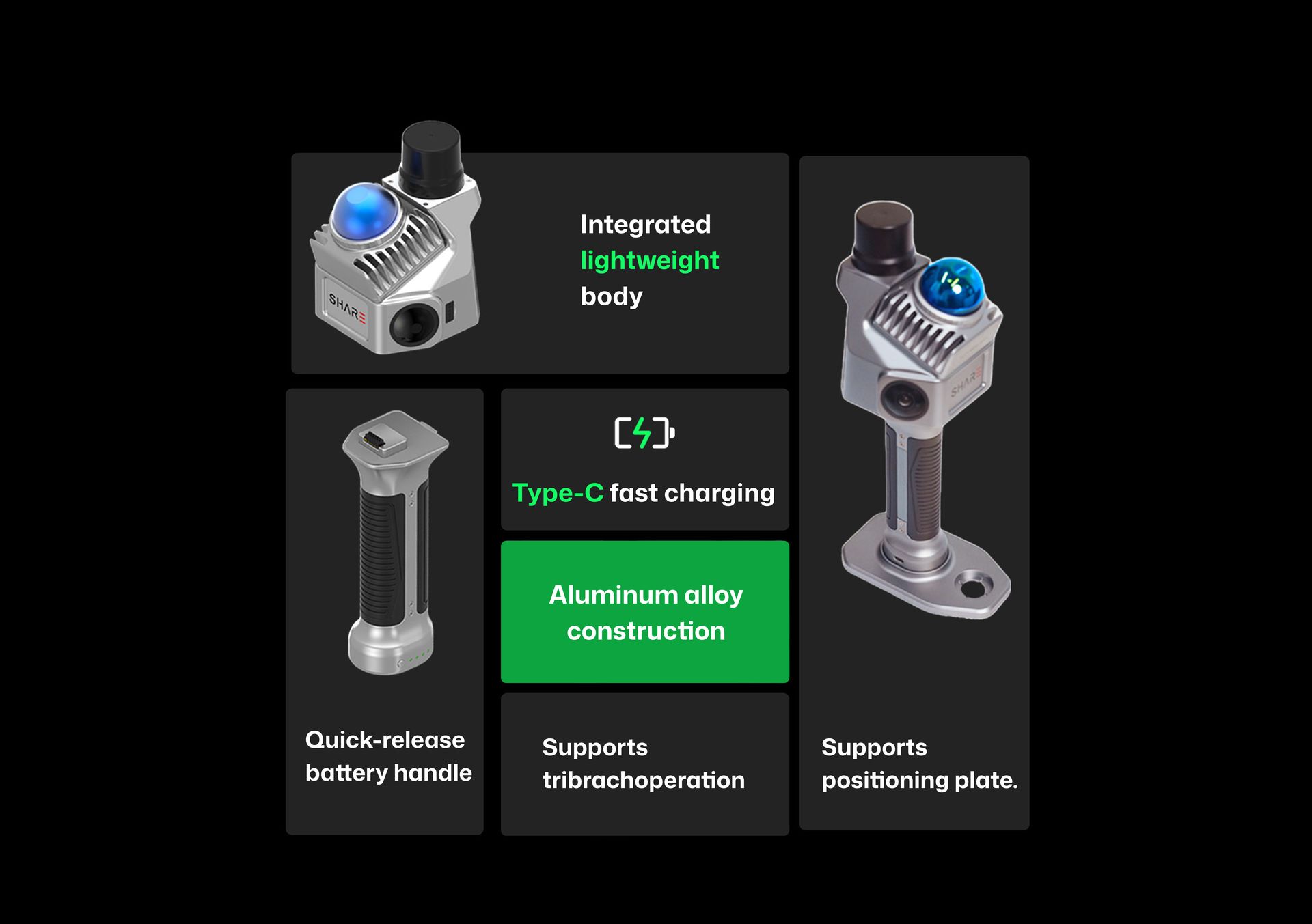
Integrated MagSafe for one-handed operation
The built-in MagSafe design enables effortless magnetic attachment, allowing single-handed operation. Eliminates hand-switching hassles and complex procedures for smooth, elegant workflow.
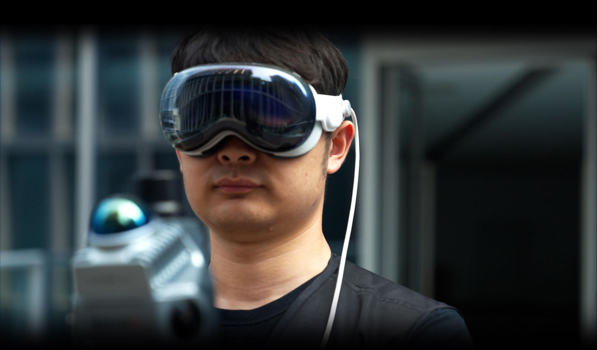
Compatible with Apple Vision Pro operation
Supports scanning workflows while wearing Apple Vision Pro, merging cutting-edge AR concepts with measurement technology to unlock new metaverse spatial experiences.
Augmented Reality Measurement Assistant
A mobile application specifically designed for handheld devices, compatible with both Android and iOS systems. Supports real-time smooth preview of colorized point clouds during operation, and allows on-device download and playback of real-time color point cloud data.