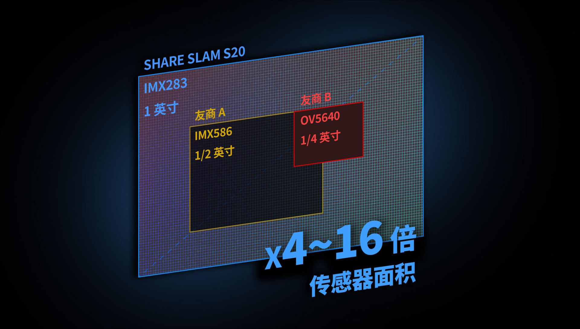
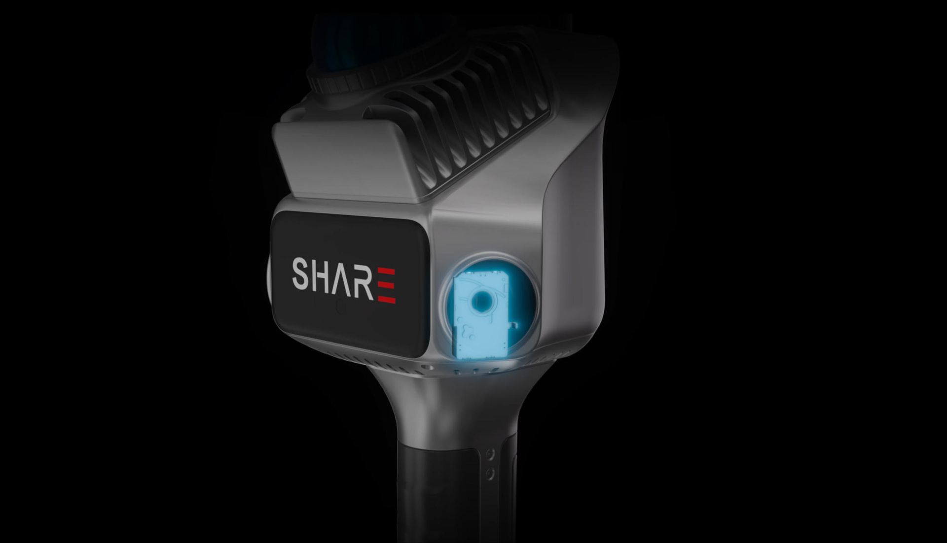
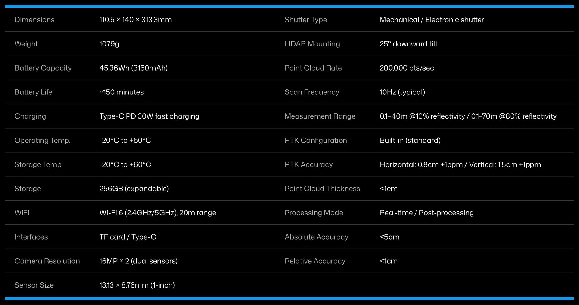
1-inch large format image sensor
Equipped with dual 1-inch large format CMOS sensors, 2.4μm pixel size, 16MP effective resolution per lens. Enhances photo clarity and delivers more accurate point cloud coloring.
Professional-grade mechanical shutter
Features global shutter to effectively eliminate rolling shutter artifacts, enabling more accurate colorized point clouds and supporting close-range photogrammetric modeling. The shutter synchronizes perfectly with the camera's POS system, ensuring precise spatial alignment for every captured frame.
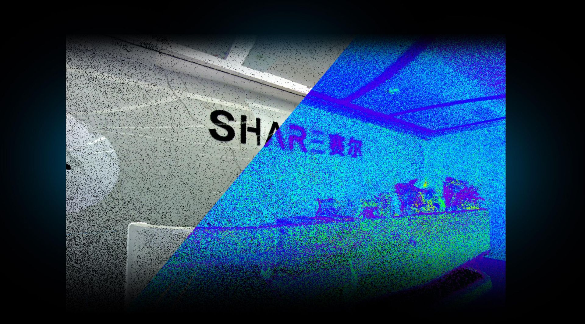
Point cloud with enhanced precision
Microsecond-level hardware synchronization ensures superior point cloud accuracy, achieving perfect alignment between colorized point clouds and intensity point clouds.
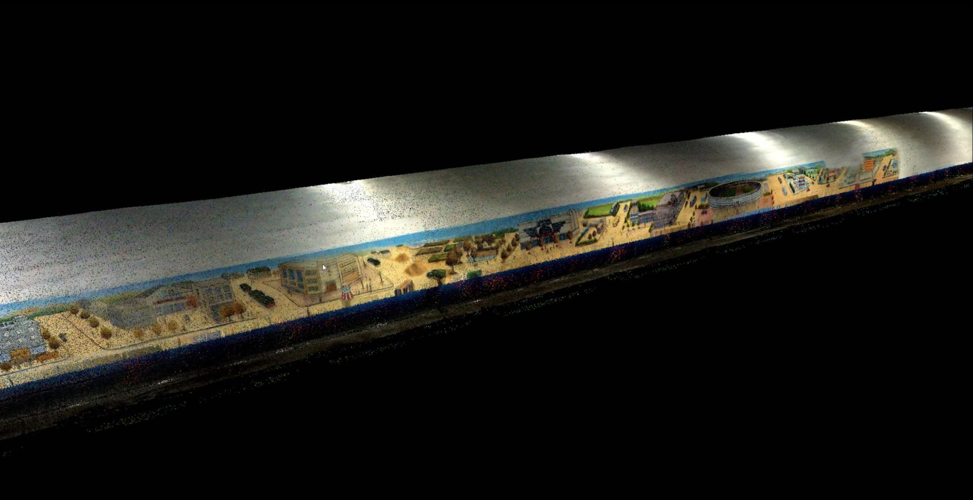
Powered by proprietary algorithms
Our self-developed fusion of laser SLAM and visual SLAM delivers robust performance, generating denser real-time point clouds with superior colorization, adaptable to complex scenarios.
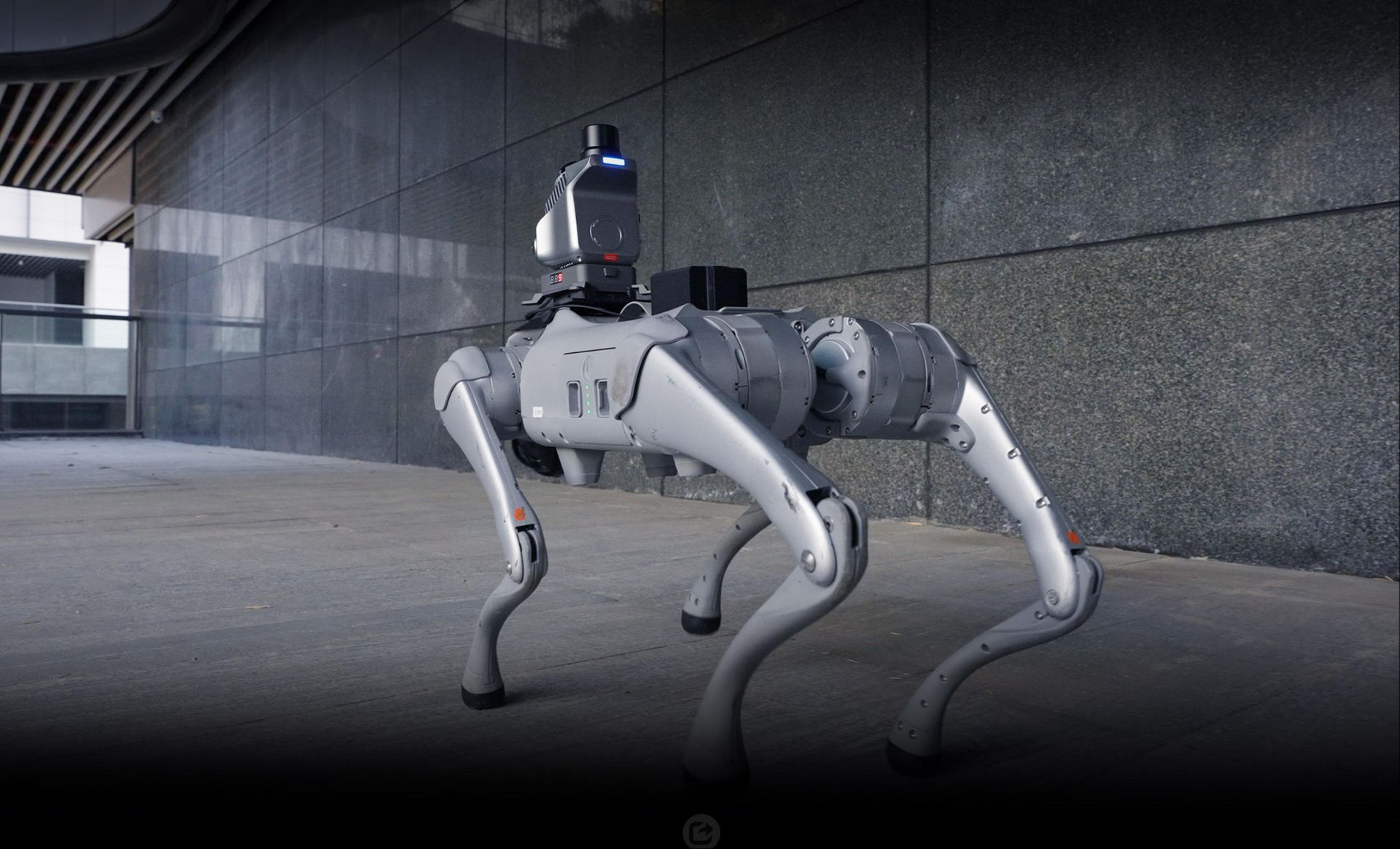
Open hardware interface
Features open hardware interfaces for seamless integration with other platforms. The open SDK enables device communication, data transfer, and operation control, providing perfect compatibility with next-generation surveying equipment like embodied AI systems.
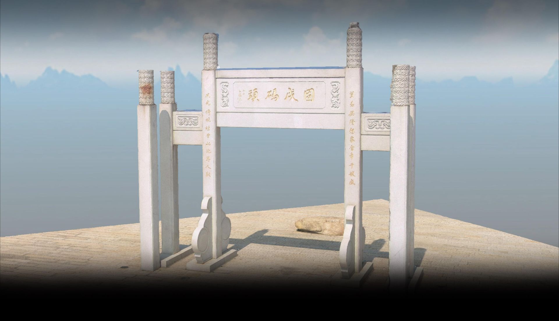
Supports Mesh Model Generation
Provides developers with full access to raw data for custom SLAM algorithm integration. Photos can be utilized for Mesh model generation, meeting diverse industry-specific data processing requirements.
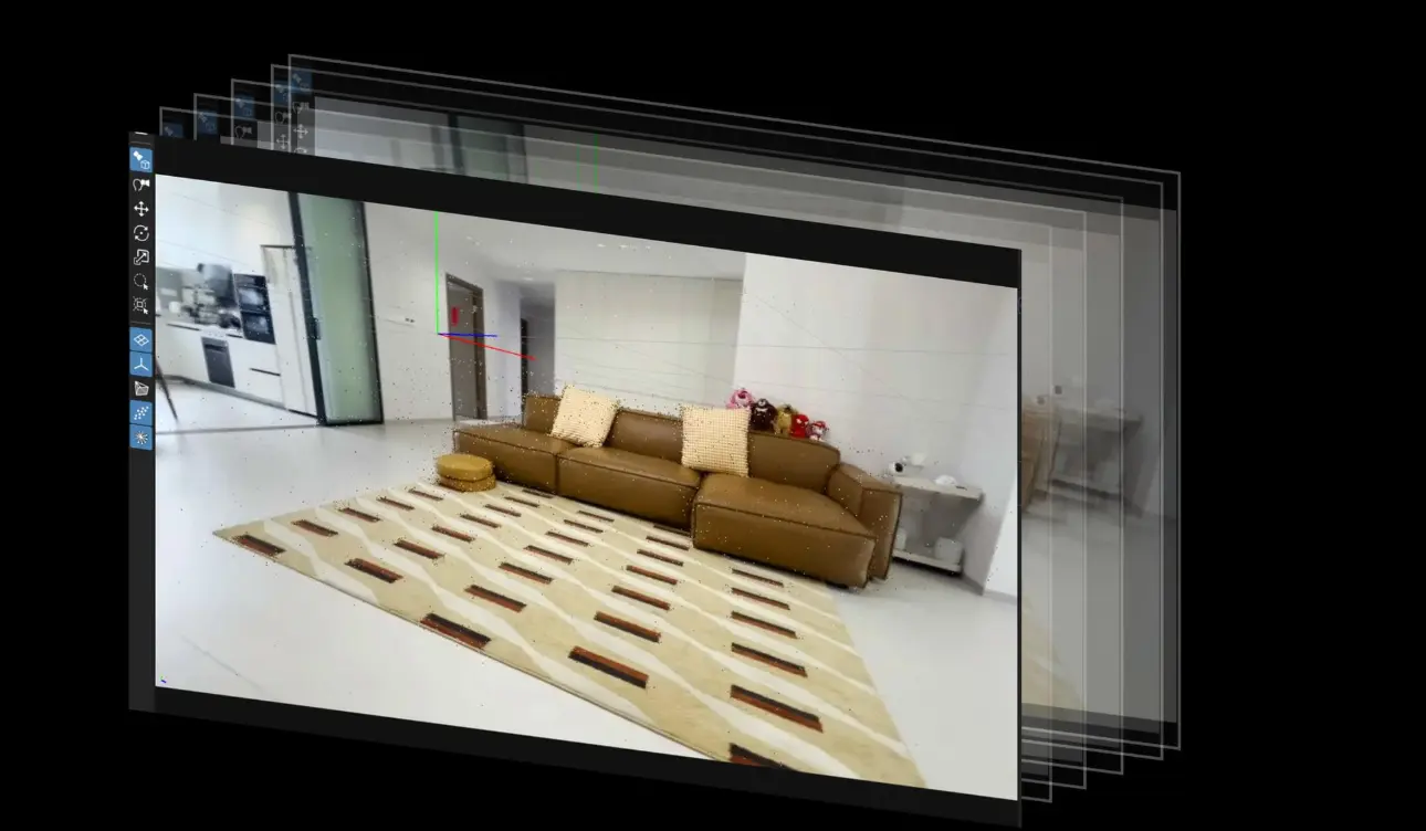
Photos Support 3DGS Modeling
Leveraging the 1-inch large-format sensor and embedded pose data, the high-resolution images with uniform color distribution are optimized for 3D Gaussian Splatting (3DGS) model generation.
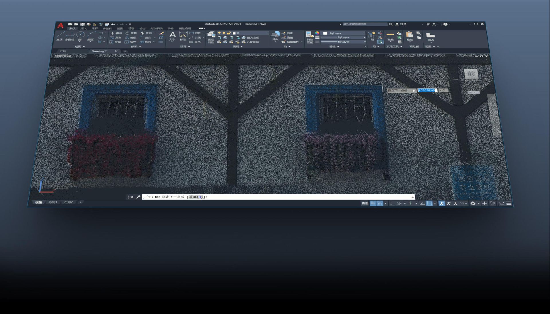
Deeply optimized for office mapping workflows
Point cloud data directly feeds into BIM/CAD workflows, enabling efficient mapping and modeling with high-precision point cloud data.
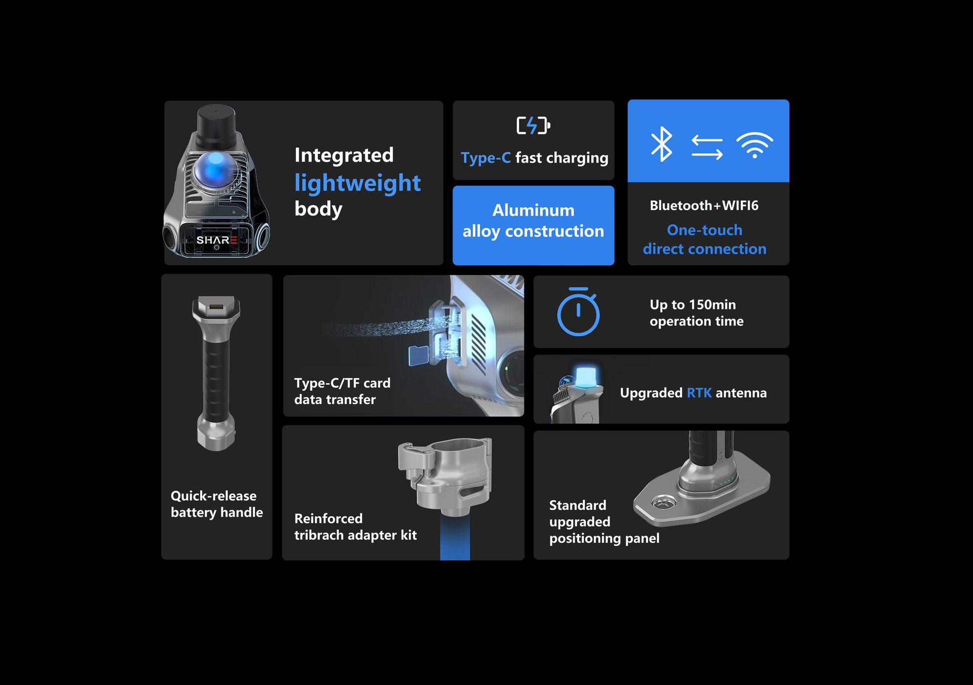
Detailed Overview