The software is simple and easy to learn, making it user-friendly and easy to master.
It has powerful aerial triangulation capabilities and high modeling efficiency. It fully supports everything from drones to large-format 150-megapixel cameras.
It comes with built-in model editing tools, eliminating the tedious import and export processes. It provides a complete model editing workflow.
Infinite Aerial Triangulation
Supports 800,000 images at 42MP resolution (64GB RAM) for full-process parallel processing (feature extraction/matching/block adjustment, etc.), without the need for manual partitioning.
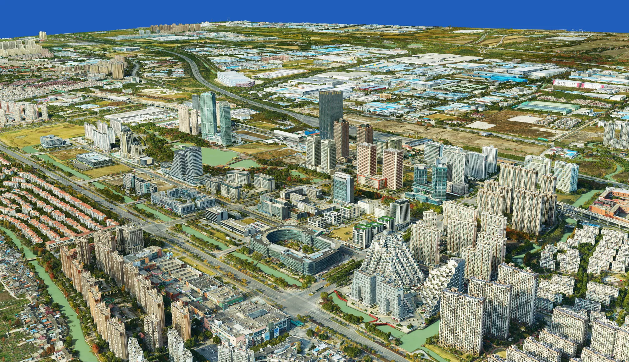
Case study: 154,000 images at 60MP resolution were modeled in 28 hours using a 60-node cluster.
Multi-source data compatibility
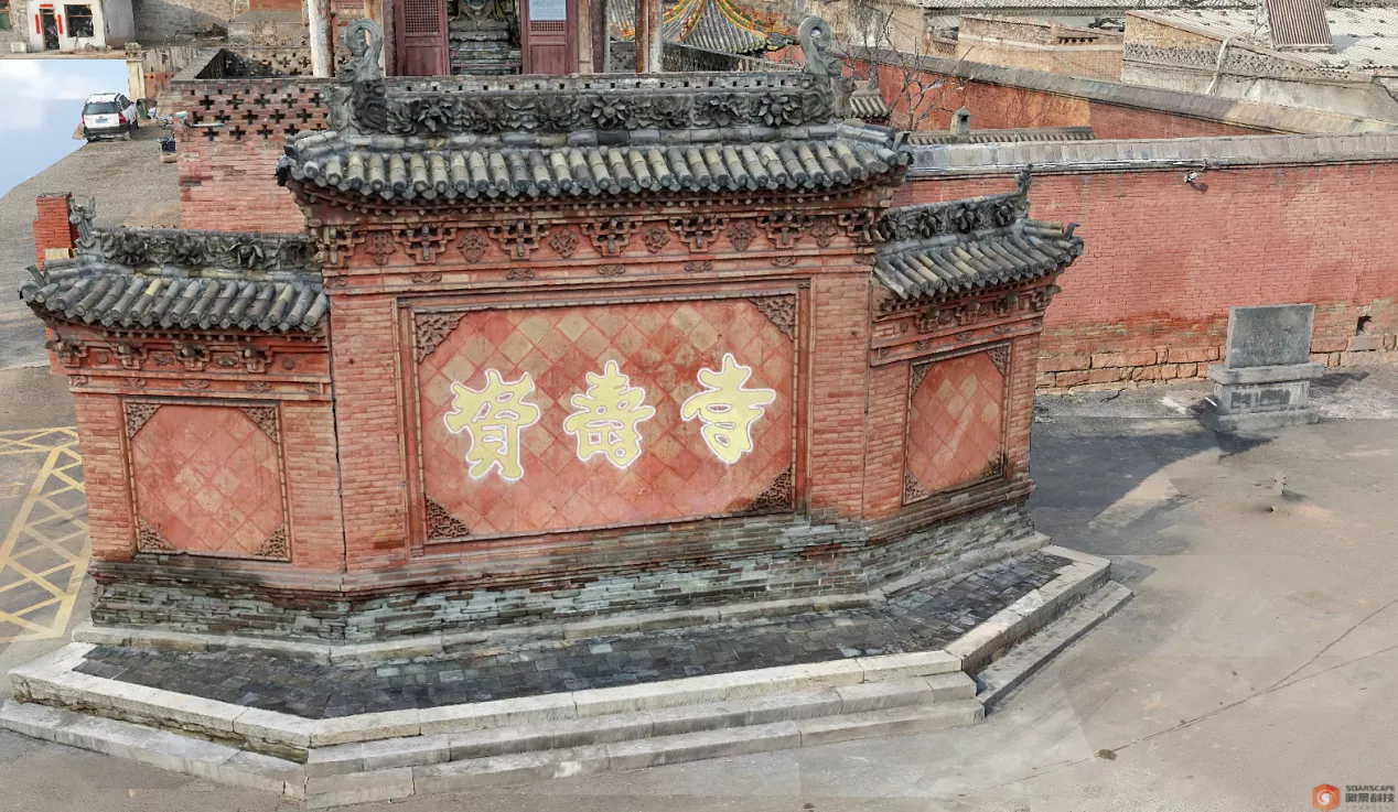
Infinite image formats: Supports all data sources, such as pinhole cameras, fisheye lenses, satellite sensors, and laser point clouds.
Infinite fusion: Automatic registration of integrated air-air-ground data, achieving multi-source heterogeneous data fusion modeling without the need for manual control points.

Cloud Computing Capability and Intelligence
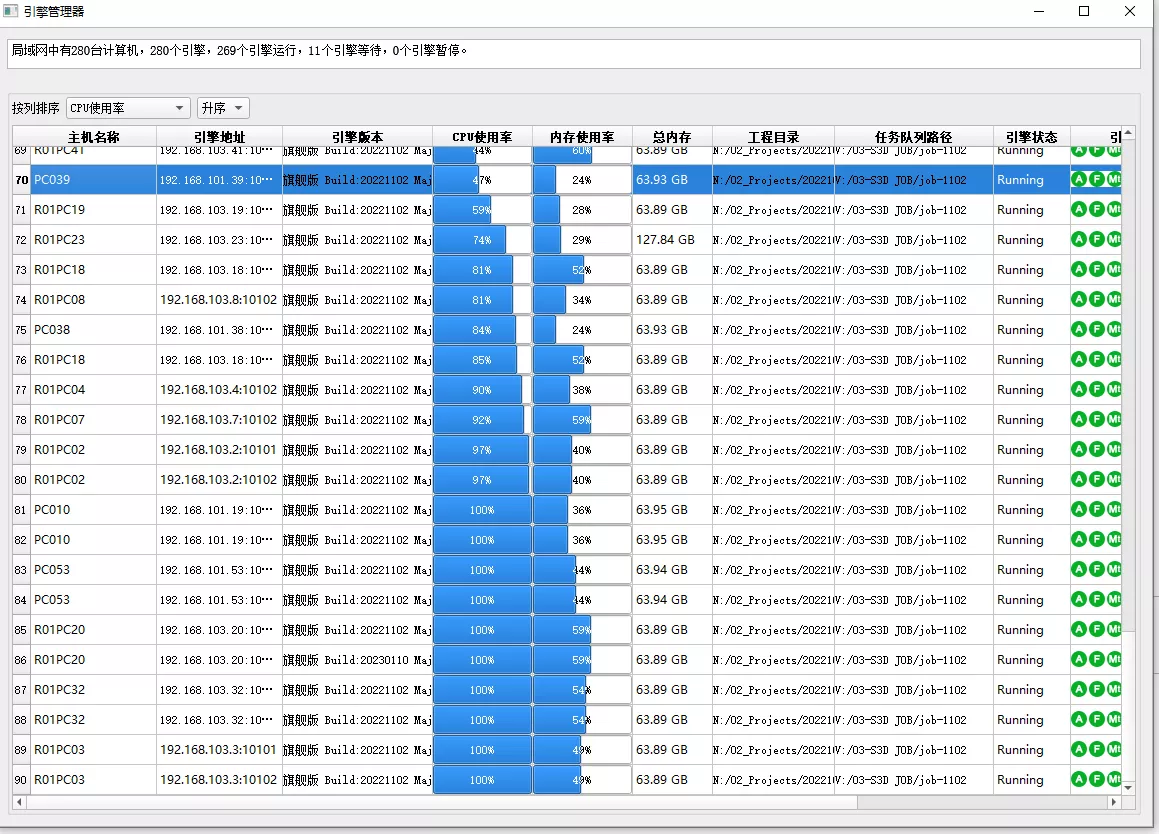
Infinite Computing Power: "Kangjing Cloud," with over 1000 GPU nodes, supports collaborative modeling with 500 nodes, completing modeling of millions of images in 48 hours.
Intelligent Features:
Artificial intelligence automatically repairs water surfaces (identification, filling holes, color homogenization);
Patented automatic identification and assignment of control points, solving the problem of manual point marking.
Function Upgrade and Efficiency Optimization
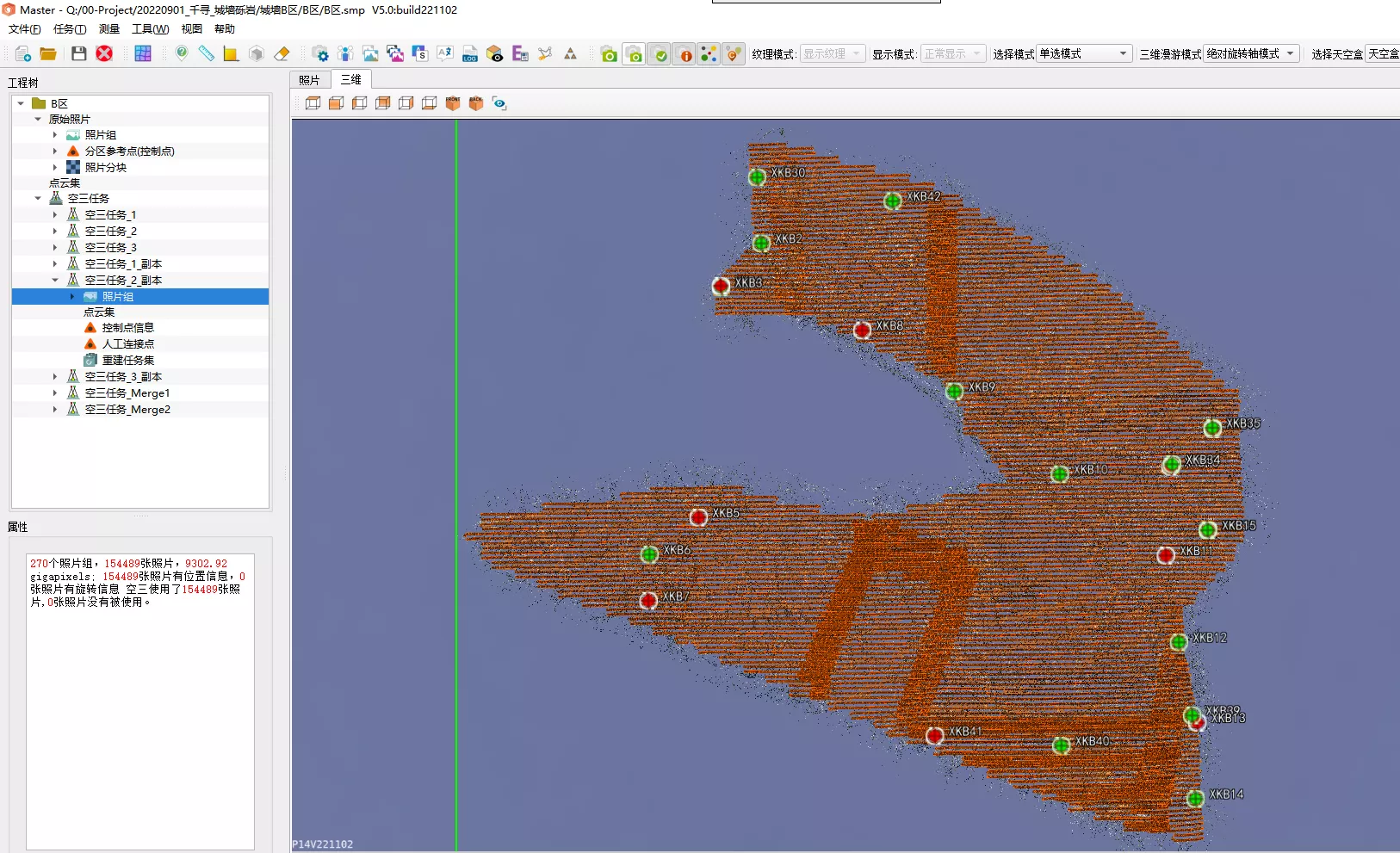
The "Performance Enhancement Mode" in the standard version supports aerial triangulation of 200,000 images in a single partition; the "Capacity Mode" increases efficiency by 30%, and 128GB of RAM theoretically supports unlimited data.
Automatic registration using overlapping data enables precise local area updates without the need for control points (e.g., re-flying, inspections, disaster comparisons).
Geometric optimization: Repair holes and thin structures, improve planar flatness;
Texture optimization: Address "mottling" and "fire clouds", support color uniformity between tiles and lighting adjustments.