NAVVIS VLX INDOOR MOBILE MAPPING SYSTEM

With the wearable solution, the user can capture complex areas up to 10 times faster than with conventional static scans while still attaining survey-grade accuracies. The NavVis Indoor Viewer processes the data from the NavVis VLX into a Google street view like web-based deliverable, without a need to install any software or upgrade PC performance capabilities. The scan results can also be imported into any 3D CAD software to generate 2D floor plans or Digital-twin, optimizing the Scan-to-BIM workflow.
NAVVIS VLX Highlights
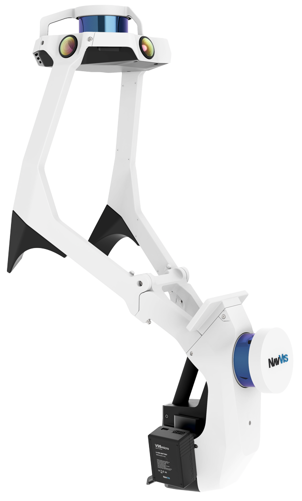
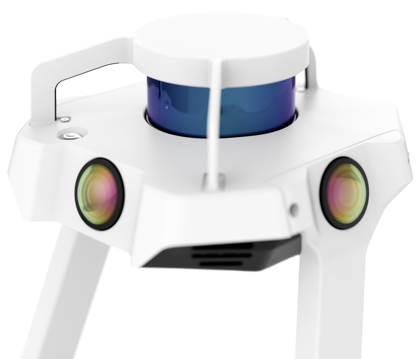
Dual LiDAR
Two multi-layer LiDAR sensors capture 3D
measurements and enable industry-leading
SLAM software in a combination that delivers
survey-grade point cloud quality.
Complete 360° capture
Once carrying the backpack with the sensors well-protected,
you can navigate into any space with its real-time interface
and map in view.
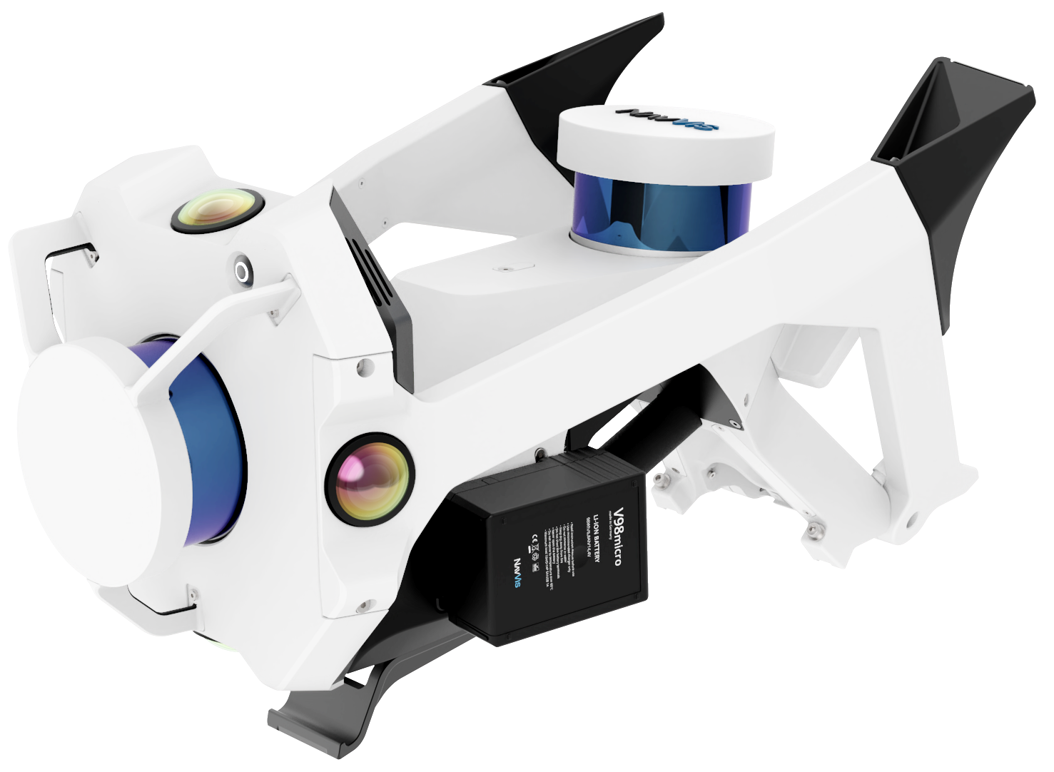
Compact
The compact design folds up into one case enabling
single operator set up and transport.
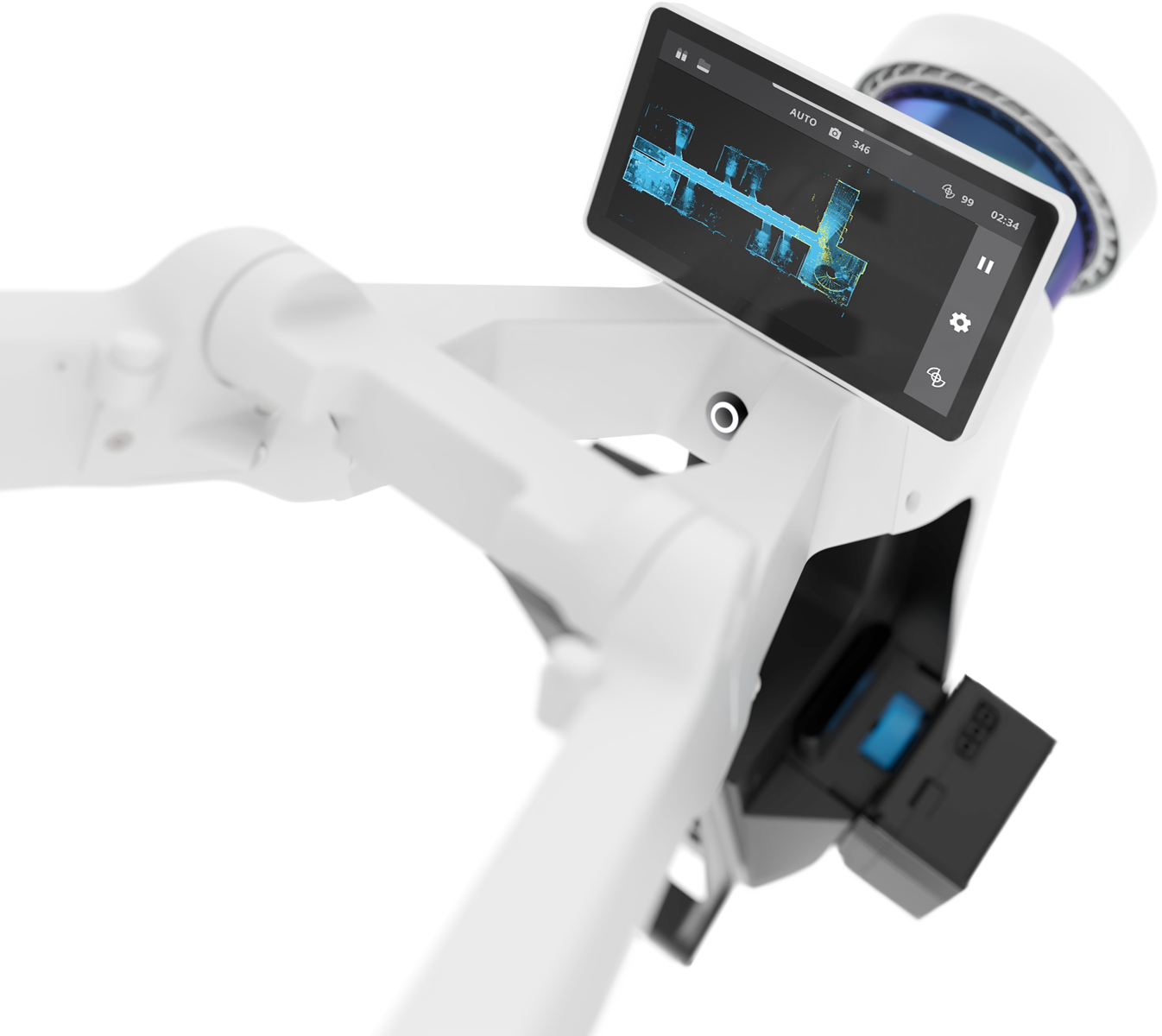
Built-in interface
The touchscreen interface displays live feedback of
what is being scanned and the data quality, and is built
into the device to allow hands-free scanning.
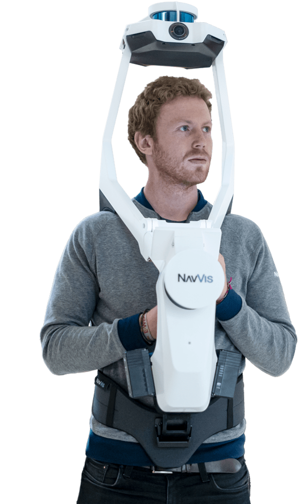
Forward-looking
A new design for wearable mapping hardware that is
strategically positioned at the front to enable targeted
scanning as well as viewing of the built-in screen.
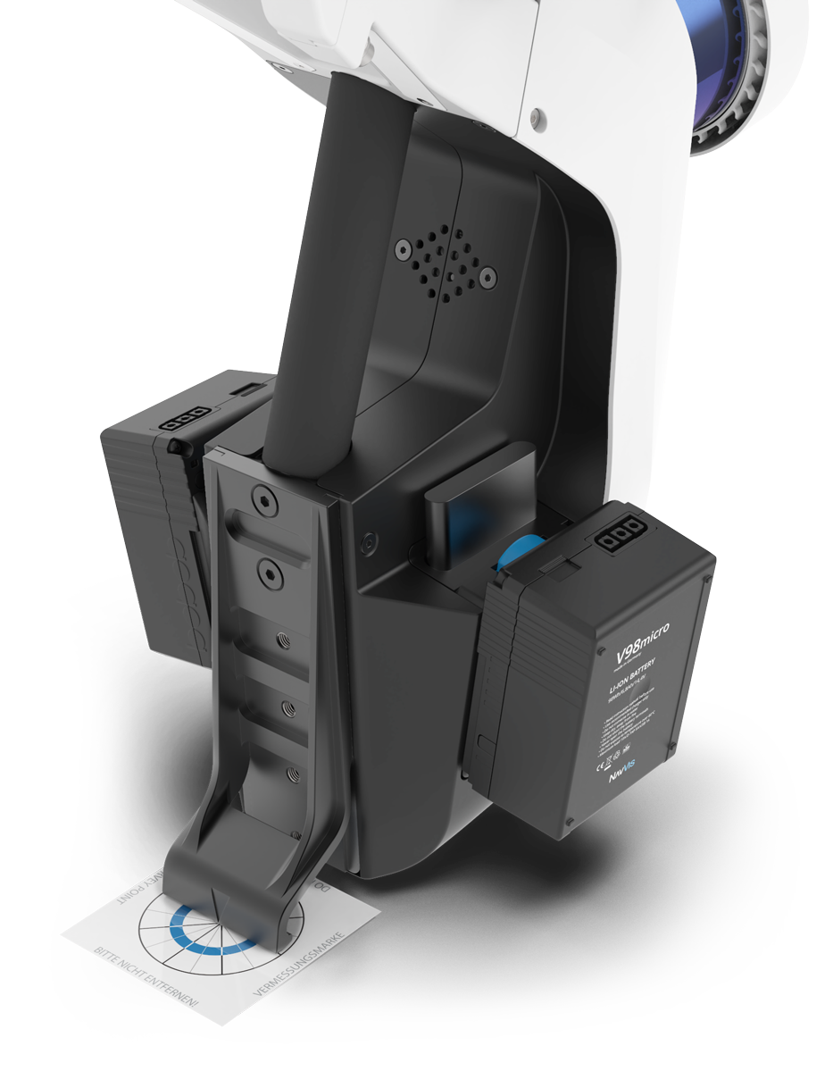
Ground Control Points
Align point clouds with control points on wall and ground for quality assurance.
- Ground and wall targets
- Simply touch the target and trigger
- Control data quality, align datasets, and eliminate drift on long scans
Survey - grade point clouds
NavVis system software features state-of-the-art SLAM technology that delivers survey-grade point cloud quality. Learn more about what sets NavVis system software apart or download NavVis VLX sample data to experience the difference.
Industry applications
Scan-to-BIM
Fast capture for scan-to-BIM workflows with the only mobile point cloud quality suitable for modeling. All-in-one reality capture enables virtual as-built verification using NavVis IndoorViewer.
CAD Floorplans
Improve efficiency in CAD floorplan workflows. Our devices quickly capture detailed point clouds of large, complex environments that can be used for CAD drawing.